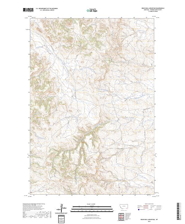
2024 Map of Bear Skull Mountain
USGS Topo · Published 2024About this map
Bear Skull Mtn rises as a prominent landmark in this drainage-rich portion of Powder River County, where the landscape is defined by the complex branching of the Baking Powder Creek system. The map details the convergence of the North Fork Baking Powder Creek and the South Fork Baking Powder Creek, illustrating how these waterways have carved the high plains of southeastern Montana. This modern survey provides a clear view of the rural infrastructure, specifically Baking Powder Rd, which serves as the primary corridor through this sparsely populated territory.
Find a feature on this map
18 named features on this map. Tap any name to fly to it.
Don’t see what you’re looking for? This feature index may not catch every label — zoom into the map to look around manually.
Map Details
Editions of this 2024 Bear Skull Mountain Map
This is the sole edition of this map. No revisions or reprints were ever made.
Other maps of this area

1954 · Ekalaka
USGS Topo · 1:250,000

1956 · Ekalaka
USGS Topo · 1:250,000

1958 · Ekalaka
USGS Topo · 1:250,000

1965 · Ekalaka
USGS Topo · 1:250,000

1970 · Pine Creek
USGS Topo · 1:24,000

1970 · Wild Bill Creek
USGS Topo · 1:24,000

1970 · Baldy Peak
USGS Topo · 1:24,000
1970 · Biddle
USGS Topo · 1:24,000
1970 · Bay Horse
USGS Topo · 1:24,000

1970 · Bear Skull Mountain
USGS Topo · 1:24,000