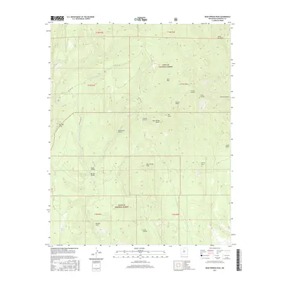
2017 Map of Bear Springs Peak
USGS Topo · Published 2017About this map
Santa Fe National Forest encompasses this high-altitude landscape in the Jemez Mountains, where the terrain is defined by a series of prominent peaks and deep drainage systems. The survey highlights significant elevations such as Bear Springs Peak, Ruiz Peak, and the distinctive Borrego Dome. These volcanic and tectonic features are bisected by numerous canyons, including Peralta Canyon, Canovas Canyon, and Hondo Canyon, which carve through the volcanic plateau. Human infrastructure is limited to specialized routes like State Hwy 290 and Indian Svc Rte 803, indicating a region primarily managed for timber, grazing, or conservation. The placement of Chamisal Tank suggests the importance of water management for livestock or wildlife in this arid upland environment. Geologic landmarks like Borrego Mesa and Tres Cerros dominate the local relief, providing a clear view of the complex topography of north-central New Mexico.
Find a feature on this map
29 named features on this map. Tap any name to fly to it.
Don’t see what you’re looking for? This feature index may not catch every label — zoom into the map to look around manually.
Map Details
Editions of this 2017 Bear Springs Peak Map
This is the sole edition of this map. No revisions or reprints were ever made.
Other maps of this area

1890 · Jemes
USGS Topo · 1:125,000

1892 · Jemes
USGS Topo · 1:125,000

1892 · Santa Clara
USGS Topo · 1:125,000

1937 · Jemez Springs
USGS Topo · 1:48,000

1943 · Jemez
USGS Topo · 1:62,500

1944 · Jemez Springs
USGS Topo · 1:62,500

1952 · Jemez Springs
USGS Topo · 1:62,500

1952 · Jemez
USGS Topo · 1:62,500

1953 · Bland
USGS Topo · 1:24,000

1953 · Santo Domingo Pueblo SW
USGS Topo · 1:24,000