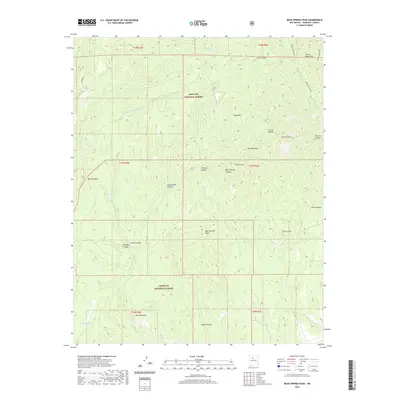
2020 Map of Bear Springs Peak
USGS Topo · Published 2020About this map
Bearhead Ridge and the surrounding volcanic terrain of the Jemez Mountains dominate this high-altitude landscape within the Santa Fe National Forest. The topography is defined by a series of prominent summits, including Bear Springs Peak and the nearby Ruiz Peak, which rise above a network of deeply etched drainages. The complex geomorphology is further illustrated by the Borrego Dome and Borrego Mesa to the west, separated from the central peaks by Borrego Canyon.
Find a feature on this map
29 named features on this map. Tap any name to fly to it.
Don’t see what you’re looking for? This feature index may not catch every label — zoom into the map to look around manually.
Map Details
Editions of this 2020 Bear Springs Peak Map
This is the sole edition of this map. No revisions or reprints were ever made.
Other maps of this area

1890 · Jemes
USGS Topo · 1:125,000

1892 · Jemes
USGS Topo · 1:125,000

1892 · Santa Clara
USGS Topo · 1:125,000

1937 · Jemez Springs
USGS Topo · 1:48,000

1943 · Jemez
USGS Topo · 1:62,500

1944 · Jemez Springs
USGS Topo · 1:62,500

1952 · Jemez Springs
USGS Topo · 1:62,500

1952 · Jemez
USGS Topo · 1:62,500

1953 · Bland
USGS Topo · 1:24,000

1953 · Santo Domingo Pueblo SW
USGS Topo · 1:24,000