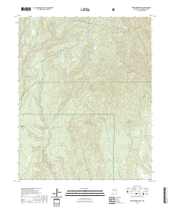
2023 Map of Bear Springs Peak
USGS Topo · Published 2023About this map
Santa Fe National Forest encompasses the majority of this landscape, defined by the high elevations of the Jemez Mountains and complex drainage systems. The settlement of Ponderosa sits at the edge of this transition, where the terrain drops toward Borrego Mesa and Borrego Canyon. High points such as Ruiz Peak, Cerro la Jara, and the namesake Bear Springs Peak anchor the topography, connected by a network of trails including the Peralta Ridge Trl and Bearhead Ridge Trl. The map details numerous canyon systems, from the deep Honda Canyon to Paliza Canyon, illustrating the rugged drainage patterns that define this section of Sandoval County. This survey provides an essential view of the area's modern land management boundaries, including various township and range lines.
Find a feature on this map
31 named features on this map. Tap any name to fly to it.
Don’t see what you’re looking for? This feature index may not catch every label — zoom into the map to look around manually.
Map Details
Editions of this 2023 Bear Springs Peak Map
This is the sole edition of this map. No revisions or reprints were ever made.
Other maps of this area

1890 · Jemes
USGS Topo · 1:125,000

1892 · Jemes
USGS Topo · 1:125,000

1892 · Santa Clara
USGS Topo · 1:125,000

1937 · Jemez Springs
USGS Topo · 1:48,000

1943 · Jemez
USGS Topo · 1:62,500

1944 · Jemez Springs
USGS Topo · 1:62,500

1952 · Jemez Springs
USGS Topo · 1:62,500

1952 · Jemez
USGS Topo · 1:62,500

1953 · Bland
USGS Topo · 1:24,000

1953 · Santo Domingo Pueblo SW
USGS Topo · 1:24,000