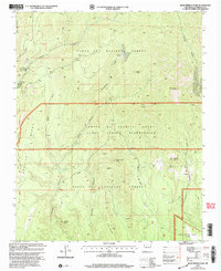
2002 Map of Bear Springs Peak
USGS Topo · Published 2003About this map
The Santa Fe National Forest and complex historical land grants define this high-altitude landscape in New Mexico. This 2002 update of a 1970 survey shows a mosaic of administrative boundaries, where the Cañada de Cochiti Grant and Jemez Indian Reservation meet the forest lands. The terrain is marked by significant topographical features such as Bear Springs Peak, Ruiz Peak, and the distinct Borrego Dome to the south. Geologic and economic activity is visible through numerous extraction sites, including a Strip Mine and various Quarry and Prospects labels scattered across the canyons. These industrial markings contrast with the presence of the Christian Life Camp in the northwest, suggesting a varied use of the canyon lands for both spiritual retreat and mineral exploration. The drainage patterns of Paliza Canyon, Guacamalla Canyon, and Borrego Canyon shape the rugged accessibility of the region.
Find a feature on this map
37 named features on this map. Tap any name to fly to it.
Don’t see what you’re looking for? This feature index may not catch every label — zoom into the map to look around manually.
Map Details
Editions of this 2002 Bear Springs Peak Map
This is the sole edition of this map. No revisions or reprints were ever made.
Other maps of this area

1890 · Jemes
USGS Topo · 1:125,000

1892 · Jemes
USGS Topo · 1:125,000

1892 · Santa Clara
USGS Topo · 1:125,000

1937 · Jemez Springs
USGS Topo · 1:48,000

1943 · Jemez
USGS Topo · 1:62,500

1944 · Jemez Springs
USGS Topo · 1:62,500

1952 · Jemez Springs
USGS Topo · 1:62,500

1952 · Jemez
USGS Topo · 1:62,500

1953 · Bland
USGS Topo · 1:24,000

1953 · Santo Domingo Pueblo SW
USGS Topo · 1:24,000