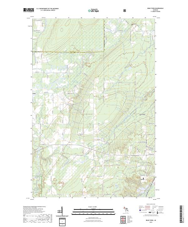
2023 Map of Bear Town
USGS Topo · Published 2023About this map
Pelkie and Bear Town anchor this northern Michigan landscape along the border of Houghton and Baraga Counties. The terrain is defined by a complex network of waterways, including the winding Otter River, Sturgeon River, and the protected Sturgeon Wild and Scenic River corridor. These rivers, along with smaller tributaries like Gristmill Creek and Kelsey Creek, drain the heavily forested lands that characterize the northern reaches of the Ottawa National Forest.
Find a feature on this map
54 named features on this map. Tap any name to fly to it.
Don’t see what you’re looking for? This feature index may not catch every label — zoom into the map to look around manually.
Map Details
Editions of this 2023 Bear Town Map
This is the sole edition of this map. No revisions or reprints were ever made.
Other maps of this area

1954 · Keweenaw Bay
USGS Topo · 1:62,500

1954 · Pelkie
USGS Topo · 1:62,500

1954 · Sidnaw
USGS Topo · 1:62,500

1955 · Herman
USGS Topo · 1:62,500

1958 · Iron River
USGS Topo · 1:250,000

1960 · Iron River
USGS Topo · 1:250,000

1961 · Iron River
USGS Topo · 1:250,000

1967 · Iron River
USGS Topo · 1:250,000
1984 · Pine Lake
USGS Topo · 1:24,000
1984 · Portage Entry
USGS Topo · 1:24,000