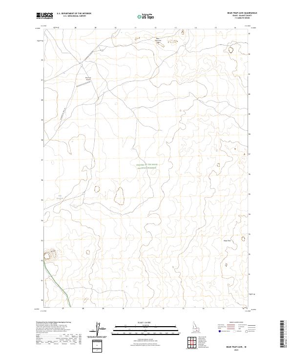
2023 Map of Bear Trap Cave
USGS Topo · Published 2023About this map
Craters Of The Moon National Preserve encompasses much of this high-altitude landscape, where the geological history of the Snake River Plain is strikingly visible. The terrain is dominated by the sprawling Wapi Flow, a massive basaltic field that stretches across the southern half of the sheet. Notable volcanic landmarks include the Bear Trap Lava Tube and the distinctive Split Butte to the west. Human activity in this remote region is limited to infrastructure like the Minidoka To Arco Rd and the Bear Trap Airport, reflecting the sparse utility of this volcanic desert. Small-scale water management is evident at Lulu Reservoir, likely serving the needs of local ranching or resource management in an otherwise arid environment.
Find a feature on this map
11 named features on this map. Tap any name to fly to it.
Don’t see what you’re looking for? This feature index may not catch every label — zoom into the map to look around manually.
Map Details
Editions of this 2023 Bear Trap Cave Map
This is the sole edition of this map. No revisions or reprints were ever made.
Other maps of this area

1954 · Pocatello
USGS Topo · 1:250,000

1955 · Idaho Falls
USGS Topo · 1:250,000

1958 · Idaho Falls
USGS Topo · 1:250,000

1958 · Pocatello
USGS Topo · 1:250,000

1972 · Schodde Well
USGS Topo · 1:24,000
1972 · Rattlesnake Butte
USGS Topo · 1:24,000

1972 · Bear Trap Cave
USGS Topo · 1:24,000

1972 · Mule Butte
USGS Topo · 1:24,000

1972 · Bear Park SW
USGS Topo · 1:24,000

1972 · Minidoka
USGS Topo · 1:24,000