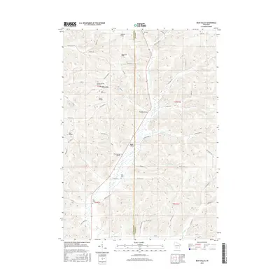
2016 Map of Bear Valley
USGS Topo · Published 2016About this map
Keyesville and Bear Valley anchor this portion of the Driftless Area, where a complex network of hollows and ridges defines the local geography. The map reveals a landscape deeply carved by tributaries of Bear Cr, including McCarville Cr, Marble Cr, and Little Bear Cr. This drainage pattern created distinct secluded valleys such as Pumpkin Hollow, Durst Hollow, and Hell Hollow, which historically dictated the placement of roads and farmsteads. Local genealogy is well-represented through the presence of four distinct burial grounds: Ward Cem, Saint Marys Cem, Saint Killian Cem, and Bear Valley Cem. The map's detail shows how the terrain rises sharply to Keyesville Ridge, separating the small communities and the winding agricultural corridors that follow the stream beds.
Find a feature on this map
56 named features on this map. Tap any name to fly to it.
Don’t see what you’re looking for? This feature index may not catch every label — zoom into the map to look around manually.
Map Details
Editions of this 2016 Bear Valley Map
This is the sole edition of this map. No revisions or reprints were ever made.
Other maps of this area

1905 · Richland Center
USGS Topo · 1:125,000

1958 · La Crosse
USGS Topo · 1:250,000

1960 · Richland Center
USGS Topo · 1:62,500

1960 · Plain
USGS Topo · 1:62,500

1960 · Muscoda
USGS Topo · 1:62,500

1960 · Spring Green
USGS Topo · 1:62,500

1961 · La Crosse
USGS Topo · 1:250,000

1965 · La Crosse
USGS Topo · 1:250,000

1976 · La Crosse
USGS Topo · 1:250,000
1983 · Lime Ridge
USGS Topo · 1:24,000