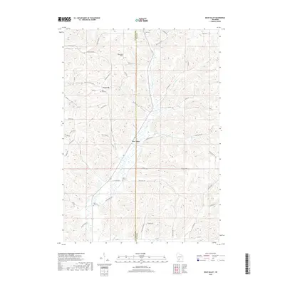
2018 Map of Bear Valley
USGS Topo · Published 2018About this map
Keyesville and the settlement of Bear Valley sit within a landscape of deeply carved valleys and high ridges along the border of Richland and Sauk counties. The topography is defined by a series of prominent hollows, including School Section Hollow, Durst Hollow, and the aptly named Hell Hollow, which channel drainage toward Bear Cr. This network of narrow ravines and high divides like Keyesville Ridge has historically dictated the placement of homesteads and winding rural roads.
Find a feature on this map
55 named features on this map. Tap any name to fly to it.
Don’t see what you’re looking for? This feature index may not catch every label — zoom into the map to look around manually.
Map Details
Editions of this 2018 Bear Valley Map
This is the sole edition of this map. No revisions or reprints were ever made.
Other maps of this area

1905 · Richland Center
USGS Topo · 1:125,000

1958 · La Crosse
USGS Topo · 1:250,000

1960 · Richland Center
USGS Topo · 1:62,500

1960 · Plain
USGS Topo · 1:62,500

1960 · Muscoda
USGS Topo · 1:62,500

1960 · Spring Green
USGS Topo · 1:62,500

1961 · La Crosse
USGS Topo · 1:250,000

1965 · La Crosse
USGS Topo · 1:250,000

1976 · La Crosse
USGS Topo · 1:250,000
1983 · Lime Ridge
USGS Topo · 1:24,000