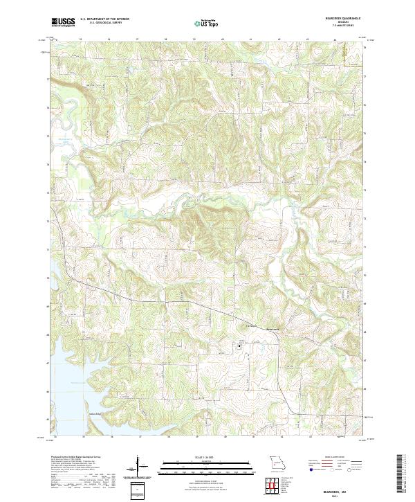
2021 Map of Bearcreek
USGS Topo · Published 2021About this map
The settlement of Bearcreek sits near the eastern edge of Cedar County, serving as a focal point for a landscape defined by its rolling ridges and winding waterways. The terrain is dominated by prominent elevations such as The Mound and Indian Ridge, which oversee a network of drainages including Bear Creek, Crabtree Br, and Price Br. To the southwest, the expansive waters of Stockton Lake reshape the river valleys, while the Sac River meanders through the western portion of the quadrangle.
Find a feature on this map
49 named features on this map. Tap any name to fly to it.
Don’t see what you’re looking for? This feature index may not catch every label — zoom into the map to look around manually.
Map Details
Editions of this 2021 Bearcreek Map
This is the sole edition of this map. No revisions or reprints were ever made.
Other maps of this area

1886 · Stockton
USGS Topo · 1:125,000

1939 · Caplinger Mills
USGS Topo · 1:24,000

1939 · Arnica
USGS Topo · 1:24,000

1941 · Caplinger Mills
USGS Topo · 1:24,000

1941 · Arnica
USGS Topo · 1:24,000

1944 · Humansville
USGS Topo · 1:24,000

1954 · Springfield
USGS Topo · 1:250,000
1956 · Fair Play
USGS Topo · 1:24,000
1956 · Stockton
USGS Topo · 1:24,000
1956 · Bearcreek
USGS Topo · 1:24,000