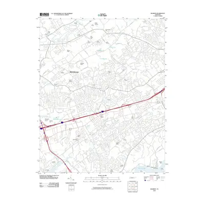
2010 Map of Bearden
USGS Topo · Published 2010About this map
Beaver Ridge and Blackoak Ridge anchor this Knoxville-area landscape, where suburban expansion meets legacy family landmarks. The mapping illustrates a complex network of residential developments and institutions like the Zion Childrens Home alongside historic burial grounds, including the Eubanks Chapel Cemetery and Cox View Cemetery. Toward the south, the terrain descends toward the banks of Watts Bar Lake and Wright Bluff, highlighting the regional reliance on the Tennessee River system for both geography and recreation.
Find a feature on this map
92 named features on this map. Tap any name to fly to it.
Don’t see what you’re looking for? This feature index may not catch every label — zoom into the map to look around manually.
Map Details
Editions of this 2010 Bearden Map
This is the sole edition of this map. No revisions or reprints were ever made.
Other maps of this area

1886 · Knoxville
USGS Topo · 1:125,000

1892 · Knoxville
USGS Topo · 1:125,000

1893 · Briceville
USGS Topo · 1:125,000

1894 · Knoxville
USGS Topo · 1:125,000

1895 · Loudon
USGS Topo · 1:125,000

1895 · Briceville
USGS Topo · 1:125,000

1895 · Knoxville
USGS Topo · 1:125,000

1896 · Briceville
USGS Topo · 1:125,000

1897 · Maynardville
USGS Topo · 1:125,000

1900 · Maynardville
USGS Topo · 1:125,000