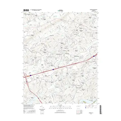
2016 Map of Bearden
USGS Topo · Published 2016About this map
Knoxville's westward expansion is heavily documented in this 2016 survey, where the suburban landscape of West Knoxville meets the distinct ridges of East Tennessee. The dominant geographic features include the parallel systems of Copper Ridge and Beaver Ridge, which channel development along the valleys of Beaver Creek. To the south, the waters of Fort Loudoun Lake form the boundary with Blount County, while the historic corridor of Kingston Pike serves as a primary artery through established neighborhoods like Bearden. Genealogists and local historians will find a dense concentration of family and community burial sites, including Bearden Cem, the Eubanks Chapel Cem, and Happy Home Cem. The transition from the rural character near Karns to the more structured subdivisions of Middlebrook Acres and Westborough illustrates the modern evolution of the Knox County landscape, preserved alongside natural landmarks such as Walker Springs and Dead Horse Lake.
Find a feature on this map
120 named features on this map. Tap any name to fly to it.
Don’t see what you’re looking for? This feature index may not catch every label — zoom into the map to look around manually.
Map Details
Editions of this 2016 Bearden Map
This is the sole edition of this map. No revisions or reprints were ever made.
Other maps of this area

1886 · Knoxville
USGS Topo · 1:125,000

1892 · Knoxville
USGS Topo · 1:125,000

1893 · Briceville
USGS Topo · 1:125,000

1894 · Knoxville
USGS Topo · 1:125,000

1895 · Loudon
USGS Topo · 1:125,000

1895 · Briceville
USGS Topo · 1:125,000

1895 · Knoxville
USGS Topo · 1:125,000

1896 · Briceville
USGS Topo · 1:125,000

1897 · Maynardville
USGS Topo · 1:125,000

1900 · Maynardville
USGS Topo · 1:125,000