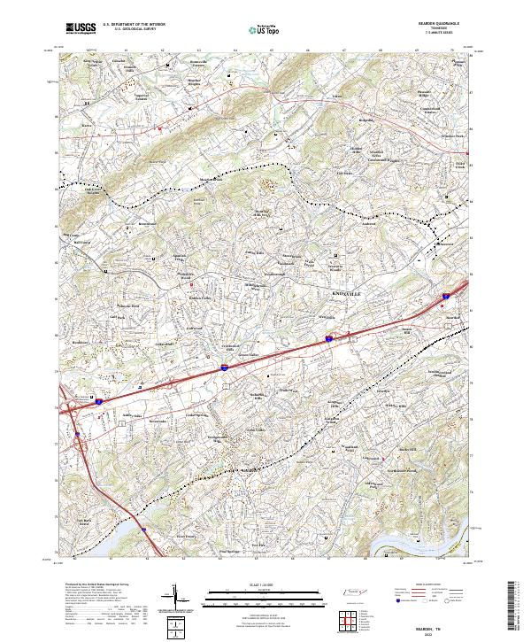
2022 Map of Bearden
USGS Topo · Published 2022About this map
Beaver Ridge and the winding course of Beaver Creek define the northern topography of this Knox County landscape, while the southern edge is shaped by the Tennessee River at Fort Loudoun Lake. The suburban development of West Knoxville is evident through dozens of established neighborhoods like Cedar Bluff, Sevenoaks, and Sevenoaks, reflecting the area's transition into a residential hub. Notable landmarks for local history and genealogy include the Berry Highland West Memorial Park Cem and several smaller family or community burial grounds such as Mars Hill Cem and Happy Home Cem.
Find a feature on this map
122 named features on this map. Tap any name to fly to it.
Don’t see what you’re looking for? This feature index may not catch every label — zoom into the map to look around manually.
Map Details
Editions of this 2022 Bearden Map
This is the sole edition of this map. No revisions or reprints were ever made.
Other maps of this area

1886 · Knoxville
USGS Topo · 1:125,000

1892 · Knoxville
USGS Topo · 1:125,000

1893 · Briceville
USGS Topo · 1:125,000

1894 · Knoxville
USGS Topo · 1:125,000

1895 · Loudon
USGS Topo · 1:125,000

1895 · Briceville
USGS Topo · 1:125,000

1895 · Knoxville
USGS Topo · 1:125,000

1896 · Briceville
USGS Topo · 1:125,000

1897 · Maynardville
USGS Topo · 1:125,000

1900 · Maynardville
USGS Topo · 1:125,000