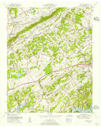
1953 Map of Bearden
USGS Topo · Published 1955About this map
Bearden and the expanding residential corridors west of Knoxville are documented in this 1953 survey, just as the postwar suburban landscape began to formalize around Westmoreland Heights and Montvue. The map captures a mix of rural heritage and modernization, where traditional centers like Byington and Ball Camp coexist with newer developments like the Deane Hill Country Club. The Tennessee River Fort Loudoun Lake shoreline dominates the southern edge, featuring Wright Ferry and the Blue Grass School.
Find a feature on this map
90 named features on this map. Tap any name to fly to it.
Don’t see what you’re looking for? This feature index may not catch every label — zoom into the map to look around manually.
Map Details
Editions of this 1953 Bearden Map
This is the sole edition of this map. No revisions or reprints were ever made.
Other maps of this area

1886 · Knoxville
USGS Topo · 1:125,000

1892 · Knoxville
USGS Topo · 1:125,000

1893 · Briceville
USGS Topo · 1:125,000

1894 · Knoxville
USGS Topo · 1:125,000

1895 · Loudon
USGS Topo · 1:125,000

1895 · Briceville
USGS Topo · 1:125,000

1895 · Knoxville
USGS Topo · 1:125,000

1896 · Briceville
USGS Topo · 1:125,000

1897 · Maynardville
USGS Topo · 1:125,000

1900 · Maynardville
USGS Topo · 1:125,000