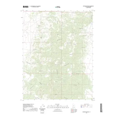
2023 Map of Bearskin Mountain
USGS Topo · Published 2023About this map
The Mineral Mountains define the high-elevation landscape of this Beaver County region, where a dense network of springs sustained livestock and early travelers through the arid Basin and Range terrain. Named water sources like Old Indian Spring, Jackrabbit Spring, and Mathew Spring are clustered around the base of peaks such as Bearskin Mtn and Bailey Mtn. The map reveals a complex system of drainage and relief, from the broad Cunningham Wash in the north to the confined depths of Wildhorse Canyon.
Find a feature on this map
45 named features on this map. Tap any name to fly to it.
Don’t see what you’re looking for? This feature index may not catch every label — zoom into the map to look around manually.
Map Details
Editions of this 2023 Bearskin Mountain Map
This is the sole edition of this map. No revisions or reprints were ever made.
Other maps of this area

1885 · Beaver
USGS Topo · 1:250,000

1953 · Cave Canyon
USGS Topo · 1:24,000

1953 · Richfield
USGS Topo · 1:250,000

1958 · Richfield
USGS Topo · 1:250,000

1958 · Beaver
USGS Topo · 1:62,500

1958 · Adamsville
USGS Topo · 1:62,500

1958 · Ranch Canyon
USGS Topo · 1:24,000

1962 · Cove Fort
USGS Topo · 1:62,500

1973 · Pinnacle Pass
USGS Topo · 1:24,000

1973 · Read
USGS Topo · 1:24,000