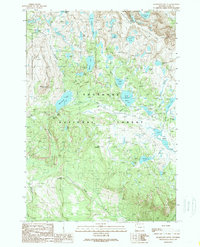
1989 Map of Beartooth Butte
USGS Topo · Published 1989About this map
Beartooth Plateau dominates this high-altitude landscape, where numerous glacial lakes and alpine streams define the topography of the Shoshone National Forest. The map detail captures a complex network of water bodies, including the prominent Beartooth Lake and the smaller, intricately shaped Island Lake, which serves as a focal point for recreation with its labeled Boat Ramp and nearby Campground. The terrain is punctuated by significant elevations like Bird Mountain and the flat-topped Table Mountain, while the western edge is bordered by the Absaroka-Beartooth Wilderness. This late-1980s survey illustrates a region largely inaccessible to traditional vehicles, relying on 4wd tracks and trails to connect features such as Beartooth Falls and the secluded Becker Lake. The inclusion of specific landmarks like the Corral and Little Campground suggests the enduring use of these highlands for seasonal grazing and backcountry exploration.
Find a feature on this map
42 named features on this map. Tap any name to fly to it.
Don’t see what you’re looking for? This feature index may not catch every label — zoom into the map to look around manually.
Map Details
Editions of this 1989 Beartooth Butte Map
2 editions found
Other maps of this area

1896 · Crandall Creek
USGS Topo · 1:125,000

1898 · Granite Mountain District
USGS Topo · 1:125,000

1899 · Crandall
USGS Topo · 1:125,000

1950 · Deep Lake
USGS Topo · 1:62,500

1954 · Billings
USGS Topo · 1:250,000

1955 · Cody
USGS Topo · 1:250,000

1956 · Alpine
USGS Topo · 1:62,500

1956 · Mount Maurice
USGS Topo · 1:62,500

1956 · Beartooth Butte
USGS Topo · 1:62,500

1957 · Billings
USGS Topo · 1:250,000