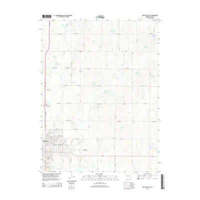
2014 Map of Beatrice East
USGS Topo · Published 2014About this map
The city of Beatrice anchors the southwestern portion of this landscape, where a dense grid of streets like Lincoln St and Grant St transitions into the agrarian expanses of Gage County. The Big Blue River snakes along the southern edge of the city, while the Homestead Expy provides a modern corridor to the west. This 2014 survey reveals an extensive water management system across the rural landscape, characterized by numerous watershed structures such as Bear Cr Reservoir 2-A, Indian Cr Reservoir 11-A, and Barnard Reservoir. Local history and genealogy interests are well-served by the presence of several established burial grounds, including Elysian View Cem to the north, Saint Joseph Cem near the city periphery, and Evergreen Home Cem situated east of the primary settlement near Sheridan.
Find a feature on this map
63 named features on this map. Tap any name to fly to it.
Don’t see what you’re looking for? This feature index may not catch every label — zoom into the map to look around manually.
Map Details
Editions of this 2014 Beatrice East Map
This is the sole edition of this map. No revisions or reprints were ever made.
Other maps of this area

1955 · Lincoln
USGS Topo · 1:250,000

1957 · Lincoln
USGS Topo · 1:250,000

1957 · Clatonia
USGS Topo · 1:24,000

1957 · Beatrice West
USGS Topo · 1:24,000

1957 · Beatrice East
USGS Topo · 1:24,000

1958 · Lincoln
USGS Topo · 1:250,000

1964 · Pickrell
USGS Topo · 1:24,000

1964 · Blue Springs
USGS Topo · 1:24,000

1965 · Adams
USGS Topo · 1:24,000

1970 · Diller NE
USGS Topo · 1:24,000