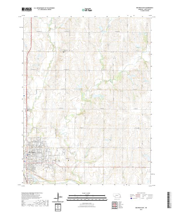
2021 Map of Beatrice East
USGS Topo · Published 2021About this map
Beatrice anchor the southwestern portion of this landscape, where the Gage County Court House stands as a central civic landmark. The town's grid of streets, including Court St and Market St, transitions into a surrounding countryside defined by agricultural sections and a complex network of reservoirs. To the south, the Big Blue River flows past the edge of the city, paralleled by the Chief Standing Bear Trl, which follows the old rail corridor. The rural areas are marked by several historic burial grounds, including Saint Joseph Cem to the north and Evergreen Home Cem to the east.
Find a feature on this map
85 named features on this map. Tap any name to fly to it.
Don’t see what you’re looking for? This feature index may not catch every label — zoom into the map to look around manually.
Map Details
Editions of this 2021 Beatrice East Map
This is the sole edition of this map. No revisions or reprints were ever made.
Other maps of this area

1955 · Lincoln
USGS Topo · 1:250,000

1957 · Lincoln
USGS Topo · 1:250,000

1957 · Clatonia
USGS Topo · 1:24,000

1957 · Beatrice West
USGS Topo · 1:24,000

1957 · Beatrice East
USGS Topo · 1:24,000

1958 · Lincoln
USGS Topo · 1:250,000

1964 · Pickrell
USGS Topo · 1:24,000

1964 · Blue Springs
USGS Topo · 1:24,000

1965 · Adams
USGS Topo · 1:24,000

1970 · Diller NE
USGS Topo · 1:24,000