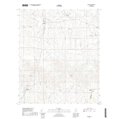
2018 Map of Beatrice
USGS Topo · Published 2018About this map
Beatrice and Tunnel Springs anchor this rural section of south Alabama, where the landscape is defined by the winding drainages of Robinson Creek and Brushy Creek. The settlement pattern follows a network of established routes like Pineville Road and County Road 42, connecting small communities such as Pineville, Riley, and Turnbull. Genealogists will find a high concentration of local burial grounds, including the Philadelphia, Savannah, and Antioch cemeteries, which often mark the sites of historic congregational centers. Along the southern border, the Monroe and Conecuh county line cuts through timberland near Pine Orchard. The presence of features like Steels Lake and Flat Creek among the ridges illustrates the importance of water sources in the development of these upland Alabama homesteads.
Find a feature on this map
61 named features on this map. Tap any name to fly to it.
Don’t see what you’re looking for? This feature index may not catch every label — zoom into the map to look around manually.
Map Details
Editions of this 2018 Beatrice Map
This is the sole edition of this map. No revisions or reprints were ever made.
Other maps of this area

1953 · Andalusia
USGS Topo · 1:250,000

1957 · Andalusia
USGS Topo · 1:250,000

1967 · Beatrice
USGS Topo · 1:24,000

1971 · Skinnerton
USGS Topo · 1:24,000

1971 · China
USGS Topo · 1:24,000

1971 · Burnt Corn
USGS Topo · 1:24,000

1971 · Beatrice
USGS Topo · 1:24,000

1972 · Monroeville
USGS Topo · 1:24,000

1972 · Natchez
USGS Topo · 1:24,000

1973 · Vredenburgh
USGS Topo · 1:24,000