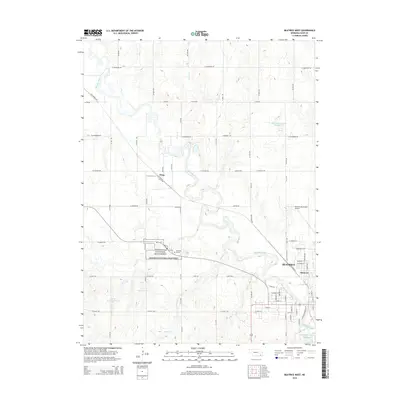
2014 Map of Beatrice West
USGS Topo · Published 2014About this map
Homestead National Monument preserves a pivotal chapter of Great Plains history west of Beatrice, defining the landscape where the Big Blue River meanders toward the city. This area showcases the transition from heritage sites like the Freeman Graves to the modern aviation of the Beatrice Municipal Airport. The western outskirts of the city are marked by the residential patterns of Hoag and Glenover, alongside a complex water management system featuring the Cub Cr Reservoir G-1 and Dusenbery-Doyle Reservoir. The grid of rural roads, such as W Elm Rd and SW 75 Rd, connects these diverse landmarks, reflecting the organized agricultural and civic expansion characteristic of Gage County in the early twenty-first century.
Find a feature on this map
73 named features on this map. Tap any name to fly to it.
Don’t see what you’re looking for? This feature index may not catch every label — zoom into the map to look around manually.
Map Details
Editions of this 2014 Beatrice West Map
This is the sole edition of this map. No revisions or reprints were ever made.
Other maps of this area

1955 · Lincoln
USGS Topo · 1:250,000

1957 · Lincoln
USGS Topo · 1:250,000

1957 · Plymouth
USGS Topo · 1:24,000

1957 · Clatonia
USGS Topo · 1:24,000

1957 · Beatrice West
USGS Topo · 1:24,000

1957 · Wilber
USGS Topo · 1:24,000

1957 · Beatrice East
USGS Topo · 1:24,000

1958 · Lincoln
USGS Topo · 1:250,000

1964 · Pickrell
USGS Topo · 1:24,000

1964 · Blue Springs
USGS Topo · 1:24,000