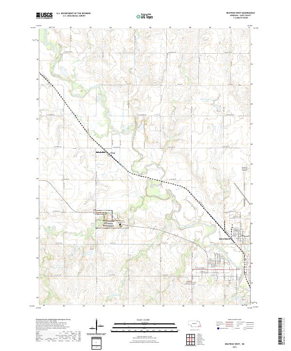
2021 Map of Beatrice West
USGS Topo · Published 2021About this map
Homestead National Monument preserves a vital piece of frontier history along the banks of Cub Cr, including the significant Freeman Grave Site. This region west of Beatrice is defined by the winding course of the Big Blue River, which dictates the landscape and road network. The map reveals the layout of the city of Beatrice and nearby Glenover, showing the expansion of the Southeast Community College Beatrice Campus and the Beatrice Municipal Airport.
Find a feature on this map
44 named features on this map. Tap any name to fly to it.
Don’t see what you’re looking for? This feature index may not catch every label — zoom into the map to look around manually.
Map Details
Editions of this 2021 Beatrice West Map
This is the sole edition of this map. No revisions or reprints were ever made.
Other maps of this area

1955 · Lincoln
USGS Topo · 1:250,000

1957 · Lincoln
USGS Topo · 1:250,000

1957 · Plymouth
USGS Topo · 1:24,000

1957 · Clatonia
USGS Topo · 1:24,000

1957 · Beatrice West
USGS Topo · 1:24,000

1957 · Wilber
USGS Topo · 1:24,000

1957 · Beatrice East
USGS Topo · 1:24,000

1958 · Lincoln
USGS Topo · 1:250,000

1964 · Pickrell
USGS Topo · 1:24,000

1964 · Blue Springs
USGS Topo · 1:24,000