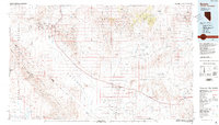
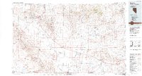
1986 Map of Beatty
USGS Topo · Published 1986About this map
The Nevada Test Site dominates the eastern landscape of this mid-1980s survey, revealing a vast high-desert expanse of topographic detail across the Amargosa Desert and into Death Valley National Monument. Near the town of Beatty, the western portion of the map is a primary resource for tracing the mining history of the Bullfrog Hills, where historic sites like Rhyolite and Gold Bar are situated among numerous claims.
Find a feature on this map
57 named features on this map. Tap any name to fly to it.
Don’t see what you’re looking for? This feature index may not catch every label — zoom into the map to look around manually.
Map Details
Editions of this 1986 Beatty Map
2 editions found
Other maps of this area

1907 · Las Vegas
USGS Topo · 1:250,000

1908 · Kawich
USGS Topo · 1:250,000

1908 · Lida
USGS Topo · 1:250,000

1908 · Furnace Creek
USGS Topo · 1:250,000

1908 · Las Vegas
USGS Topo · 1:250,000

1908 · Ballarat
USGS Topo · 1:250,000

1910 · Furnace Creek
USGS Topo · 1:250,000

1913 · Lida
USGS Topo · 1:250,000

1913 · Ballarat
USGS Topo · 1:250,000
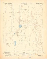
1942 · Emigrant Valley
USGS Topo · 1:125,000