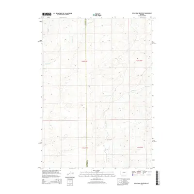
2015 Map of Beauchamp Reservoir
USGS Topo · Published 2015About this map
The Natrona and Converse County line bisects this high plains landscape, where water resources define the topography of central Wyoming. Beauchamp Reservoir serves as a focal point for the drainage systems of Cole Creek and Derrick Draw, illustrating the critical role of managed water in this arid environment. The map details the Township and Range grid system across T36N and T35N, providing a precise framework for land ownership and cattle ranching history. Transportation is limited to sparse corridors like E Ormsby Rd and various unimproved trails, reflecting the open, low-density character of the region. Local hydrology is further marked by the path of Sand Spring Creek as it winds through the northern sections of the quadrangle.
Find a feature on this map
10 named features on this map. Tap any name to fly to it.
Don’t see what you’re looking for? This feature index may not catch every label — zoom into the map to look around manually.
Map Details
Editions of this 2015 Beauchamp Reservoir Map
This is the sole edition of this map. No revisions or reprints were ever made.
Other maps of this area

1949 · Campbell Hill
USGS Topo · 1:24,000

1949 · Glenrock NW
USGS Topo · 1:24,000

1949 · Pratts Soda Lakes
USGS Topo · 1:24,000

1950 · Campbell Hill
USGS Topo · 1:24,000

1950 · Glenrock NW
USGS Topo · 1:24,000

1950 · Pratts Soda Lakes
USGS Topo · 1:24,000

1954 · Torrington
USGS Topo · 1:250,000

1955 · Newcastle
USGS Topo · 1:250,000

1955 · Arminto
USGS Topo · 1:250,000

1955 · Casper
USGS Topo · 1:250,000