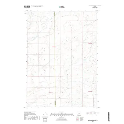
2017 Map of Beauchamp Reservoir
USGS Topo · Published 2017About this map
Beauchamp Reservoir serves as a central landmark in this high plains landscape straddling the line between Natrona and Converse Counties. The drainage patterns of the region are defined by Sand Spring Cr and Cole Cr, which flow through an open environment marked by land management boundaries and cattle-ranching infrastructure. The network of corridors such as E Ormsby Rd and Co Rd 22 provide limited access to the interior, where the topography is punctuated by named landforms like Derrick Draw and the broad wash of Sage Creek. The map reflects a modern era of land use where large-scale ranching and mineral exploration are the primary human imprints on the terrain.
Find a feature on this map
12 named features on this map. Tap any name to fly to it.
Don’t see what you’re looking for? This feature index may not catch every label — zoom into the map to look around manually.
Map Details
Editions of this 2017 Beauchamp Reservoir Map
This is the sole edition of this map. No revisions or reprints were ever made.
Other maps of this area

1949 · Campbell Hill
USGS Topo · 1:24,000

1949 · Glenrock NW
USGS Topo · 1:24,000

1949 · Pratts Soda Lakes
USGS Topo · 1:24,000

1950 · Campbell Hill
USGS Topo · 1:24,000

1950 · Glenrock NW
USGS Topo · 1:24,000

1950 · Pratts Soda Lakes
USGS Topo · 1:24,000

1954 · Torrington
USGS Topo · 1:250,000

1955 · Newcastle
USGS Topo · 1:250,000

1955 · Arminto
USGS Topo · 1:250,000

1955 · Casper
USGS Topo · 1:250,000