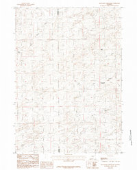
1984 Map of Beauchamp Reservoir
USGS Topo · Published 1984About this map
The county line between Natrona Co and Converse Co divides this high plains landscape, where seasonal drainage patterns and isolated water sources dictated the rhythm of ranching and land use in the mid-1980s. The eponymous Beauchamp Reservoir serves as a central point for water management in an area defined by winding gullies and intermittent streams. Significant topographic landmarks like Eagle Point and a prominent Hill rise above the drainage networks of Jim Draw and Derrick Draw, illustrating the complex erosion patterns typical of the Wyoming basin. This provisional survey captures the region just as modern geographic data was beginning to be formalized from original manuscript drawings, preserving the location of vital watering spots like Sand Springs and the headwaters of Cole Creek, Spring Creek, and Sand Creek before further development or environmental shifts altered these sensitive high-desert watersheds.
Find a feature on this map
10 named features on this map. Tap any name to fly to it.
Don’t see what you’re looking for? This feature index may not catch every label — zoom into the map to look around manually.
Map Details
Editions of this 1984 Beauchamp Reservoir Map
This is the sole edition of this map. No revisions or reprints were ever made.
Other maps of this area

1949 · Campbell Hill
USGS Topo · 1:24,000

1949 · Glenrock NW
USGS Topo · 1:24,000

1949 · Pratts Soda Lakes
USGS Topo · 1:24,000

1950 · Campbell Hill
USGS Topo · 1:24,000

1950 · Glenrock NW
USGS Topo · 1:24,000

1950 · Pratts Soda Lakes
USGS Topo · 1:24,000

1954 · Torrington
USGS Topo · 1:250,000

1955 · Newcastle
USGS Topo · 1:250,000

1955 · Arminto
USGS Topo · 1:250,000

1955 · Casper
USGS Topo · 1:250,000