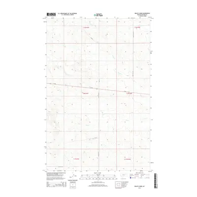
2014 Map of Beauty Creek
USGS Topo · Published 2014About this map
Beauty Cr and its many tributaries, including Dirty Cr and Soda Cr, define the drainage patterns of this McCone County landscape. The area is characterized by a network of rural routes that follow the natural topography, such as Beauty Valley Rd and Chalk Butte Rd. This 2014 survey documents the remote ranching and grazing lands of eastern Montana, where the terrain is marked by coulees and creek beds like Nelson Cr and Cotton Cr. The rectilinear township and range lines, such as t18n r45e, overlay the irregular natural features, illustrating the systematic division of the American West. Researchers can trace the path of Skull Creek Rd across the southern sections, providing insight into the sparse infrastructure and large-scale land use typical of this high plains region.
Find a feature on this map
16 named features on this map. Tap any name to fly to it.
Don’t see what you’re looking for? This feature index may not catch every label — zoom into the map to look around manually.
Map Details
Editions of this 2014 Beauty Creek Map
This is the sole edition of this map. No revisions or reprints were ever made.
Other maps of this area

1954 · Jordan
USGS Topo · 1:250,000

1954 · Glendive
USGS Topo · 1:250,000

1956 · Jordan
USGS Topo · 1:250,000

1957 · Glendive
USGS Topo · 1:250,000

1958 · Jordan
USGS Topo · 1:250,000

1958 · Glendive
USGS Topo · 1:250,000

1964 · Jordan
USGS Topo · 1:250,000

1965 · Hedstrom Lake
USGS Topo · 1:24,000

1965 · Watkins
USGS Topo · 1:24,000
1965 · Berry School
USGS Topo · 1:24,000