
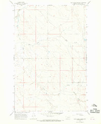
1965 Map of Hedstrom Lake
USGS Topo · Published 1968About this map
Hedstrom Lake anchors this high-plains landscape, where the borders of McCone, Prairie, and Garfield counties converge. Surveyed in the mid-1960s, the map reveals a sparsely populated terrain defined by its drainage systems and the quiet infrastructure of ranching life. Skull Creek and Hay Creek carve through the undulating topography, leading toward prominent landmarks like Red Butte. The presence of a small Cem and the remote Two Furrow Road speak to the isolation of these eastern Montana uplands during this era. This survey is particularly useful for visualizing the historic county line intersections and the primitive road network that connected early 20th-century homesteads and water sources like the several marked wells scattered across the northern sections.
Find a feature on this map
10 named features on this map. Tap any name to fly to it.
Don’t see what you’re looking for? This feature index may not catch every label — zoom into the map to look around manually.
Map Details
Editions of this 1965 Hedstrom Lake Map
This is the sole edition of this map. No revisions or reprints were ever made.
Other maps of this area

1954 · Jordan
USGS Topo · 1:250,000

1954 · Glendive
USGS Topo · 1:250,000

1956 · Jordan
USGS Topo · 1:250,000

1957 · Glendive
USGS Topo · 1:250,000

1958 · Jordan
USGS Topo · 1:250,000

1958 · Glendive
USGS Topo · 1:250,000

1964 · Jordan
USGS Topo · 1:250,000

1965 · Hedstrom Lake SE
USGS Topo · 1:24,000

1965 · Heitz School
USGS Topo · 1:24,000
1965 · Tree Coulee School
USGS Topo · 1:24,000