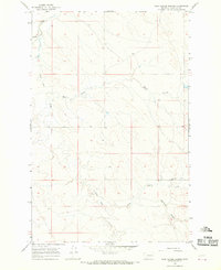
1965 Map of Tree Coulee School
USGS Topo · Published 1968About this map
Tree Coulee Sch stands as a focal point in this remote corner of Garfield County, marking the sparse rural settlement pattern typical of the eastern Montana plains during the mid-1960s. The landscape is defined by an intricate network of drainages and seasonal watercourses, including the winding Little Dry Creek and Dry Antelope Creek. These coulees and creeks provided the essential water and shelter for ranching operations in a region where geography dictated the placement of every homestead and schoolhouse. The map traces the rugged paths of Beaver Coulee and Neuhardt Coulee, illustrating how local topography influenced the development of unimproved roads and livestock wells. This survey captures a moment when small, isolated schools still served as the civic anchors for ranching families scattered across the expansive township and range grid.
Find a feature on this map
12 named features on this map. Tap any name to fly to it.
Don’t see what you’re looking for? This feature index may not catch every label — zoom into the map to look around manually.
Map Details
Editions of this 1965 Tree Coulee School Map
This is the sole edition of this map. No revisions or reprints were ever made.
Other maps of this area

1954 · Jordan
USGS Topo · 1:250,000

1954 · Forsyth
USGS Topo · 1:250,000

1956 · Jordan
USGS Topo · 1:250,000

1957 · Forsyth
USGS Topo · 1:250,000

1958 · Jordan
USGS Topo · 1:250,000

1958 · Forsyth
USGS Topo · 1:250,000

1964 · Jordan
USGS Topo · 1:250,000

1965 · Hedstrom Lake
USGS Topo · 1:24,000

1965 · Little Chalk Butte
USGS Topo · 1:24,000

1965 · Hedstrom Lake SE
USGS Topo · 1:24,000