
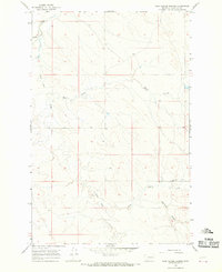
1965 Map of Little Chalk Butte
USGS Topo · Published 1968About this map
Little Chalk Butte rises as the central landmark in this 1960s survey of eastern Montana's Garfield County. The landscape is defined by an intricate network of drainage systems, notably Crow Rock Creek and its many tributary coulees. This map reveals the dispersed nature of mid-century prairie life, where a single institution like the East Uall Sch served a wide geographical area.
Find a feature on this map
10 named features on this map. Tap any name to fly to it.
Don’t see what you’re looking for? This feature index may not catch every label — zoom into the map to look around manually.
Map Details
Editions of this 1965 Little Chalk Butte Map
This is the sole edition of this map. No revisions or reprints were ever made.
Other maps of this area

1954 · Jordan
USGS Topo · 1:250,000

1954 · Forsyth
USGS Topo · 1:250,000

1956 · Jordan
USGS Topo · 1:250,000

1957 · Forsyth
USGS Topo · 1:250,000

1958 · Jordan
USGS Topo · 1:250,000

1958 · Forsyth
USGS Topo · 1:250,000

1964 · Jordan
USGS Topo · 1:250,000

1965 · Rock Springs School
USGS Topo · 1:24,000

1965 · Hedstrom Lake SE
USGS Topo · 1:24,000
1965 · Tree Coulee School
USGS Topo · 1:24,000