
1965 Map of Rock Springs School
USGS Topo · Published 1968About this map
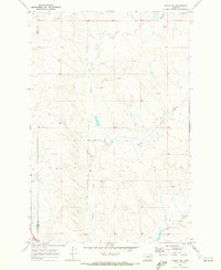
Rock Springs and the surrounding high plains of Eastern Montana are documented here during the mid-1960s, revealing a sparse ranching landscape where water management and rural education defined the community structure. The map highlights the transition between Garfield and Rosebud counties, showing how life centered around the Rock Springs Sch and the northern Southerland Sch. Small-scale water engineering is evident through landmarks like Hagler's Dam and the Kreger Res, which supported livestock along Rock Springs Creek and Fulton Creek. The terrain is marked by distinct rises like Kropf, providing an intricate look at the fence lines and unimproved dirt roads that connected these isolated homesteads and schools before more modern infrastructure arrived.
Find a feature on this map
10 named features on this map. Tap any name to fly to it.
Don’t see what you’re looking for? This feature index may not catch every label — zoom into the map to look around manually.
Map Details
Editions of this 1965 Rock Springs School Map
This is the sole edition of this map. No revisions or reprints were ever made.
Other maps of this area

1954 · Forsyth
USGS Topo · 1:250,000

1957 · Forsyth
USGS Topo · 1:250,000

1958 · Forsyth
USGS Topo · 1:250,000

1965 · Little Chalk Butte
USGS Topo · 1:24,000
1965 · Crow Rock
USGS Topo · 1:24,000
1965 · Coleman Coulee
USGS Topo · 1:24,000
1965 · Red Buttes
USGS Topo · 1:24,000
1965 · Crow Rock SE
USGS Topo · 1:24,000
1969 · Angela NE
USGS Topo · 1:24,000
1969 · Alkali Creek
USGS Topo · 1:24,000