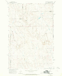
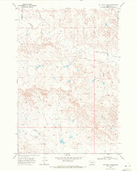
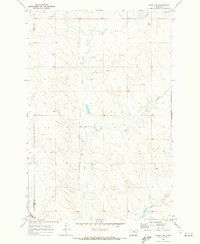
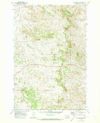
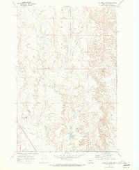
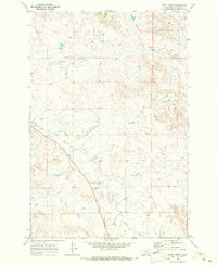
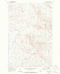
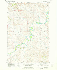
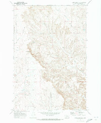
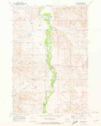
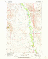
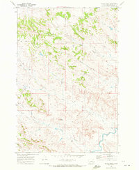
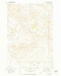
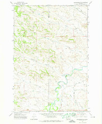
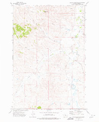
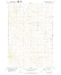
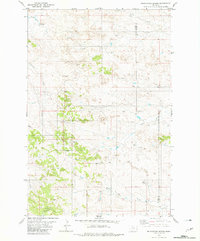
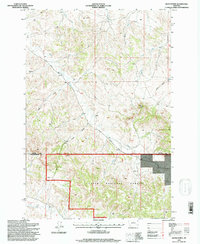
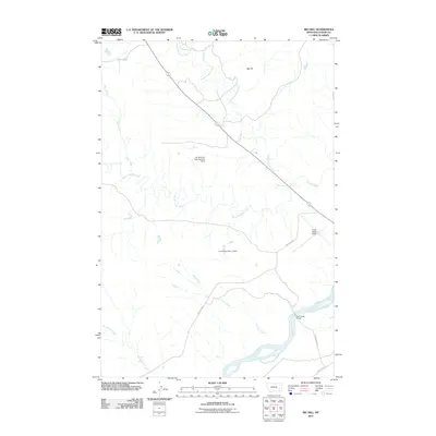
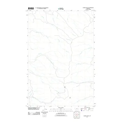
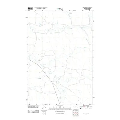
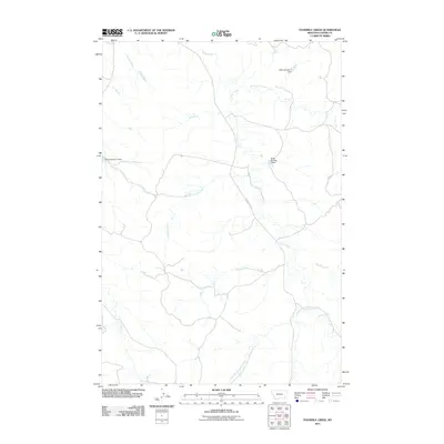
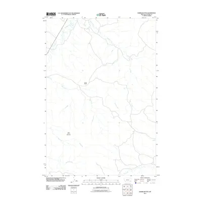
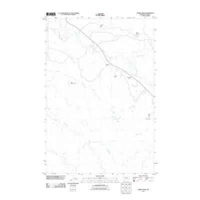
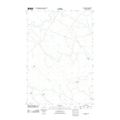
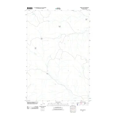
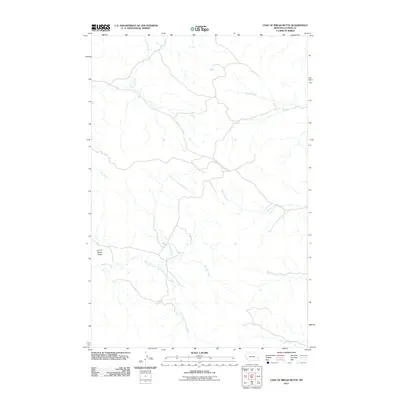
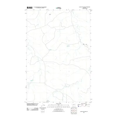
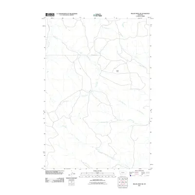
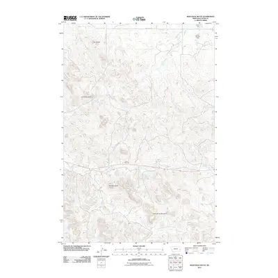
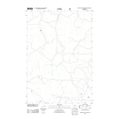
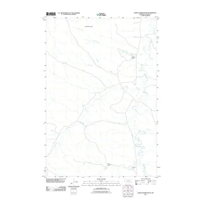
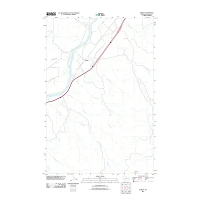
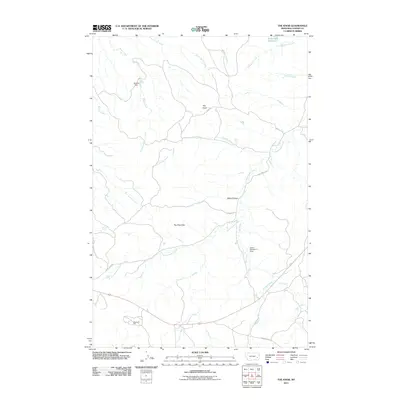
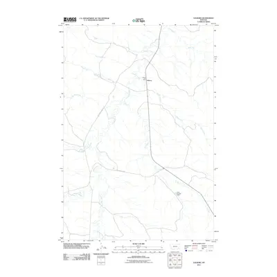
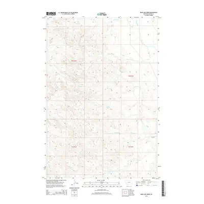
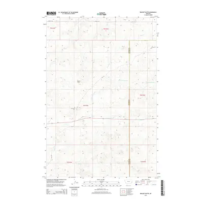
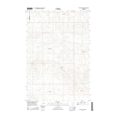
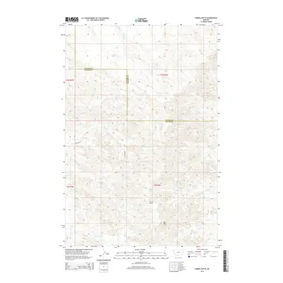
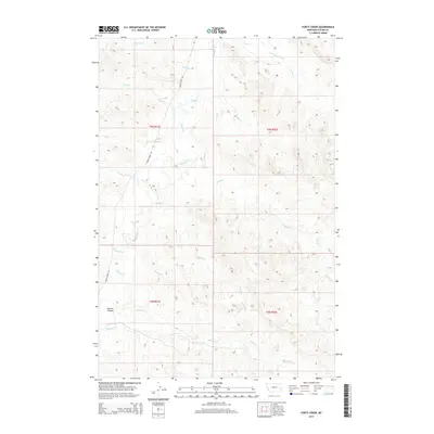
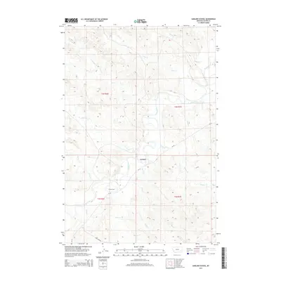
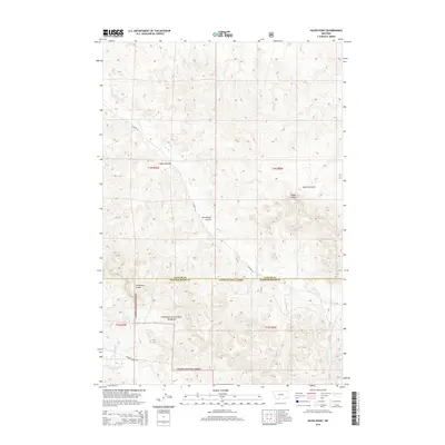
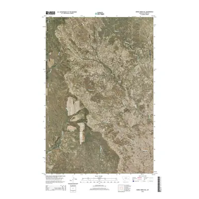
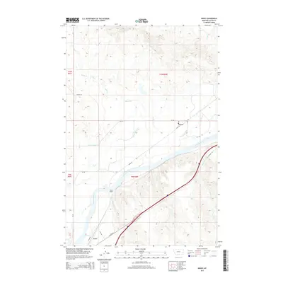
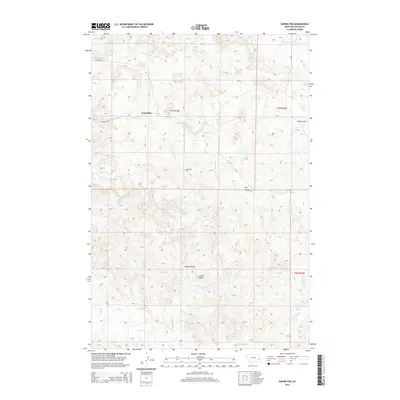
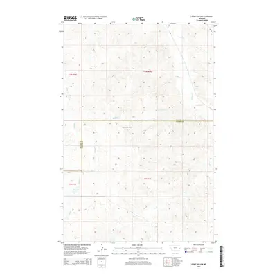
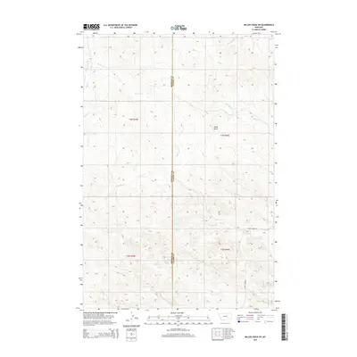
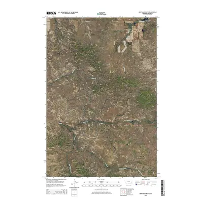
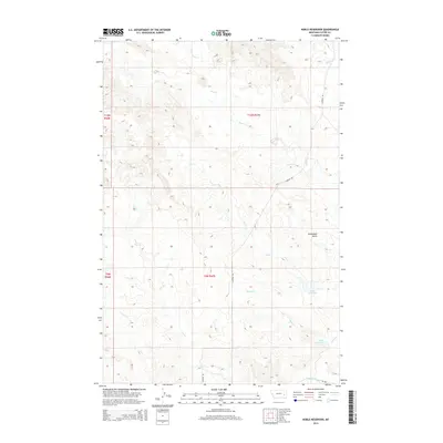
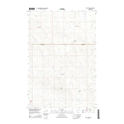
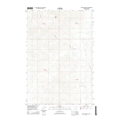
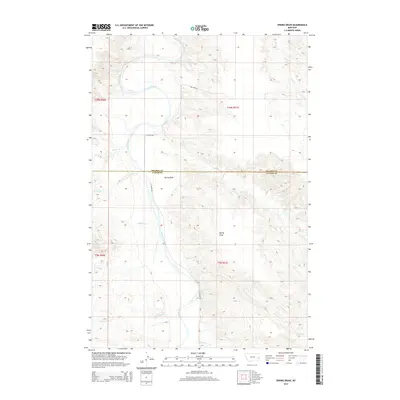
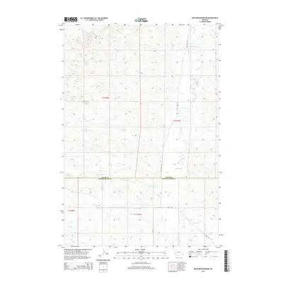
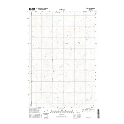
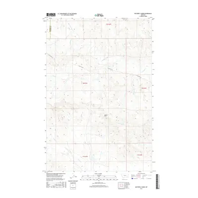
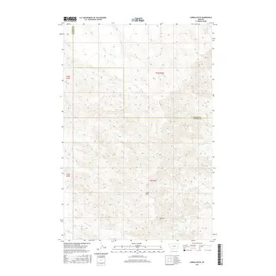
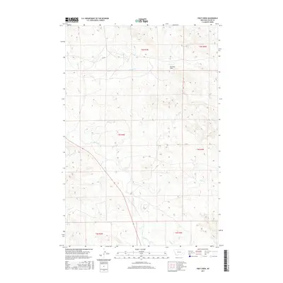
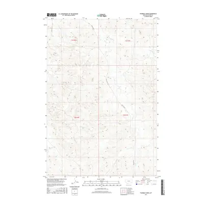
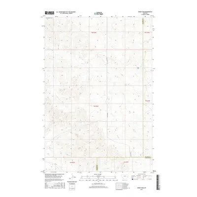
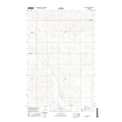
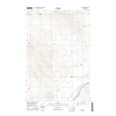
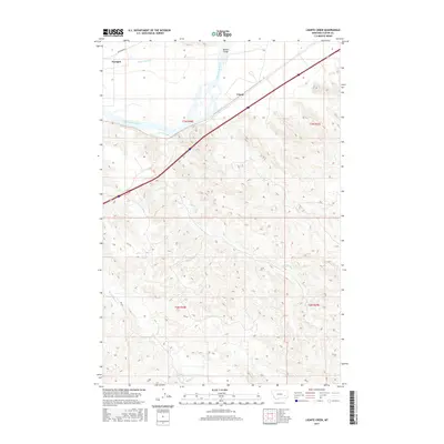
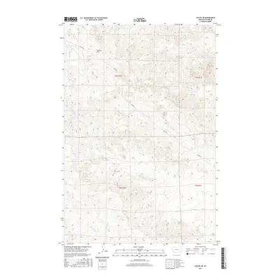
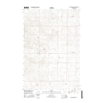
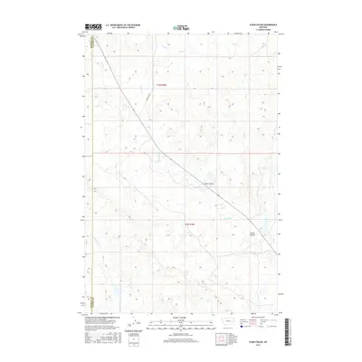
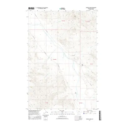
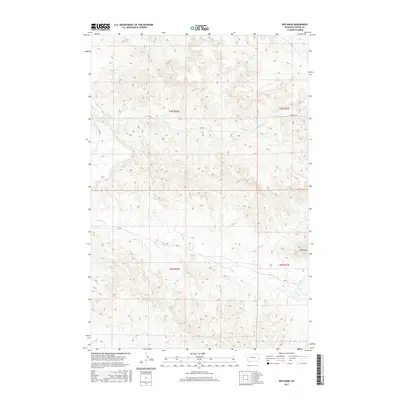
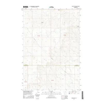
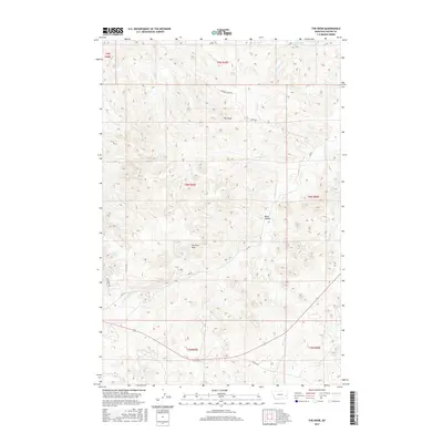
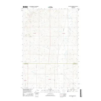
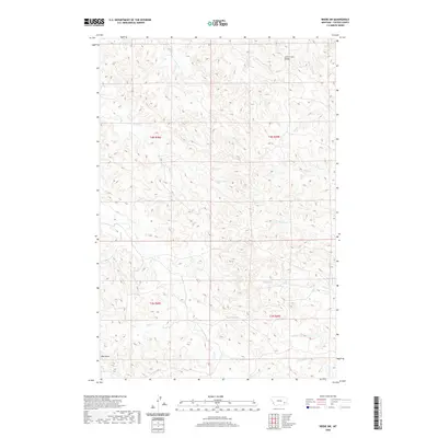
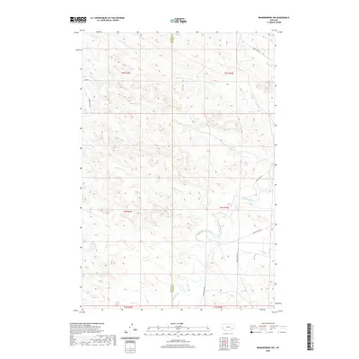
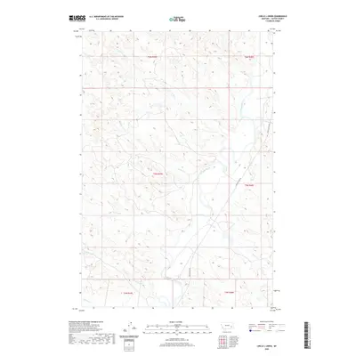
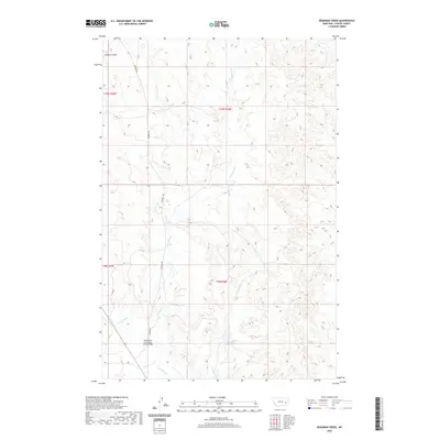
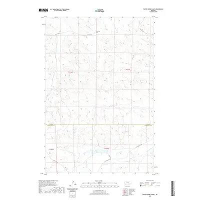
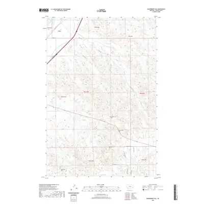
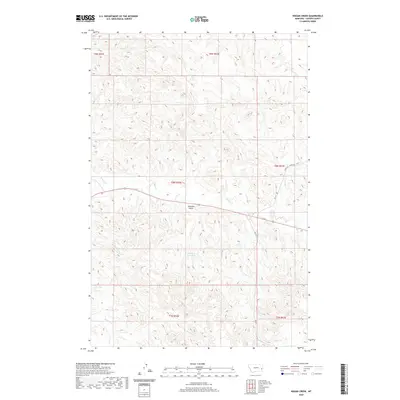
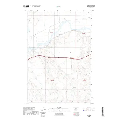
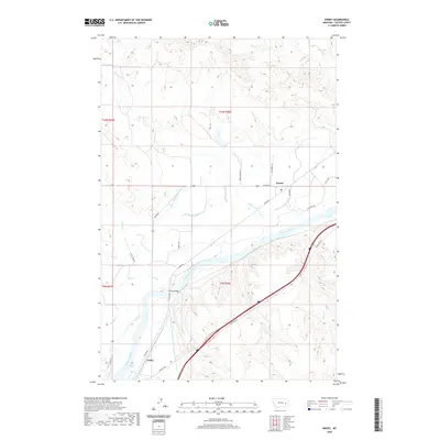
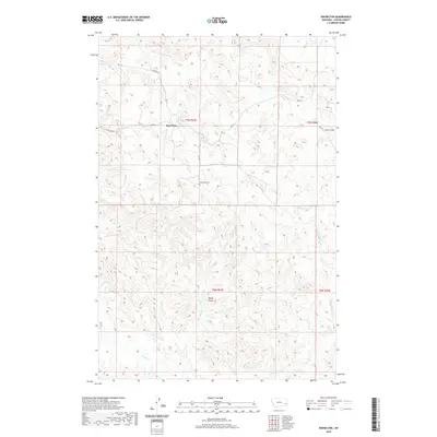
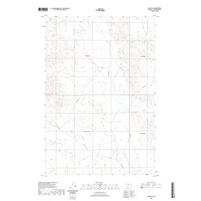
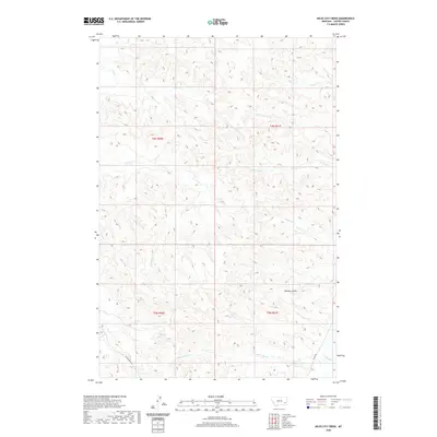
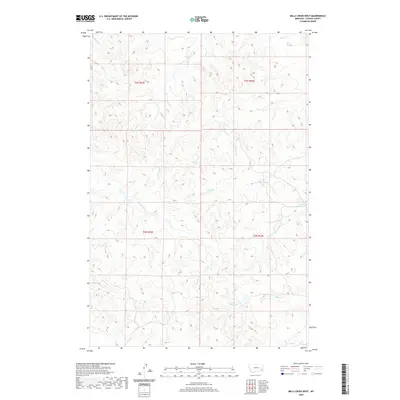
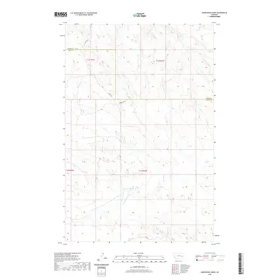
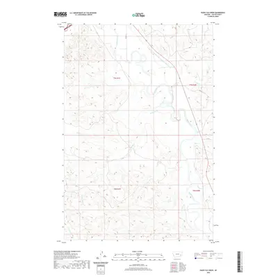
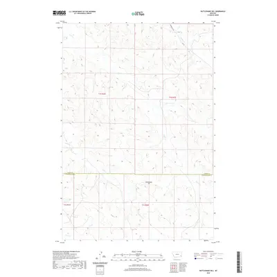
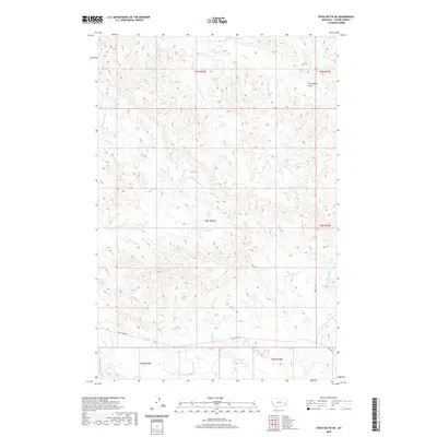
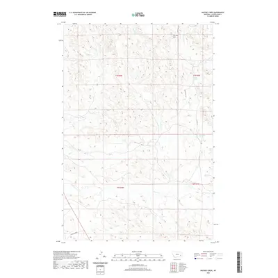
1965 Map of Crow Rock SE
USGS Topo · Published 1969About this map
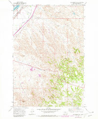
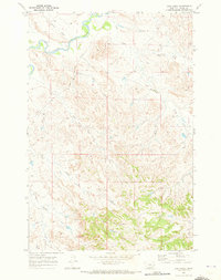
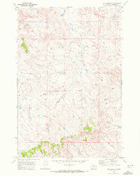
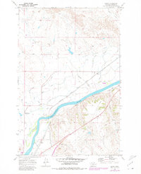
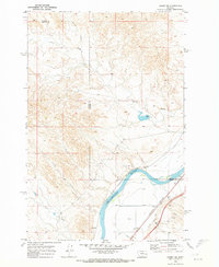
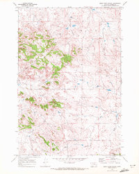
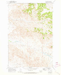
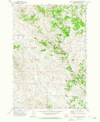
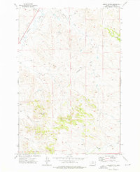
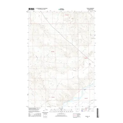
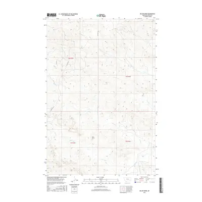
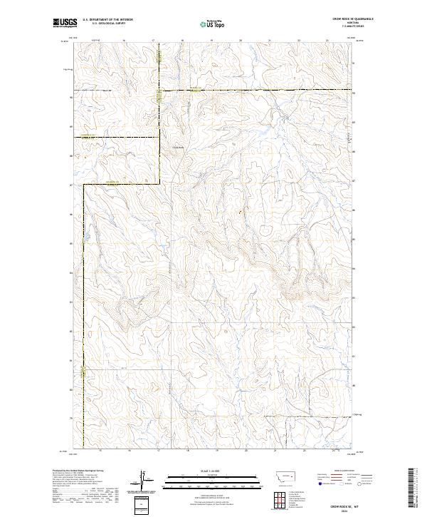
Chalk Butte stands as a prominent topographical landmark in this 1965 field-checked survey of the Montana interior. The landscape is defined by its complex drainage network, where Wolf Creek and Crow Rock Creek carve through the terrain, meeting near the intersection of several county lines. This area represents a crossroads of local administration, showing the convergence of Garfield, Rosebud, Custer, and Prairie counties. Human presence in this open range is sparse but distinct, marked by the Fairview Sch and several remote wells. Evidence of resource exploration appears in the form of a Prospect located near the headwaters of the East Fork Creek, while Grimes Creek drains the southeastern portion of the quadrangle. The map captures a moment in the mid-1960s when these rural schoolhouses and small-scale mining interests still anchored the local geography.
Find a feature on this map
13 named features on this map. Tap any name to fly to it.
Don’t see what you’re looking for? This feature index may not catch every label — zoom into the map to look around manually.
Map Details
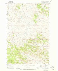
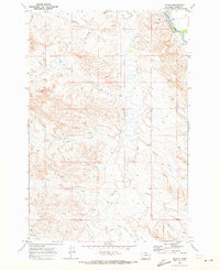
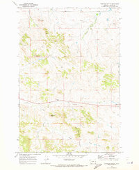
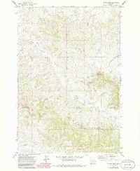
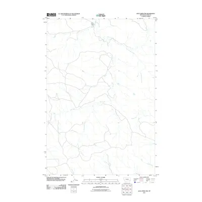
Editions of this 1965 Crow Rock SE Map
This is the sole edition of this map. No revisions or reprints were ever made.
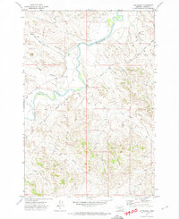
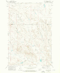
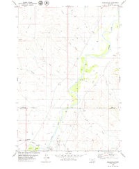
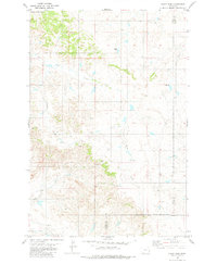
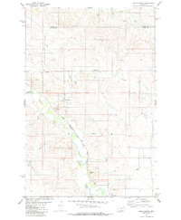
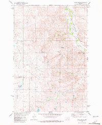
Historical Maps of Rosebud County Through Time
464 maps found
1965 Crow Rock SE
Custer County, MT
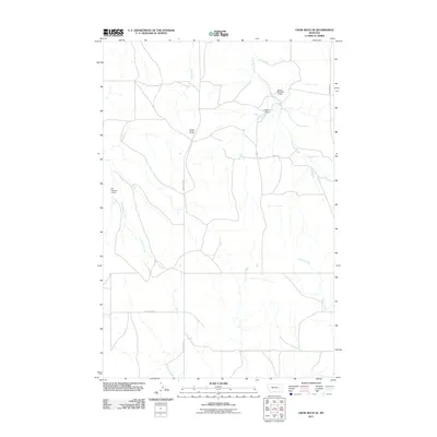
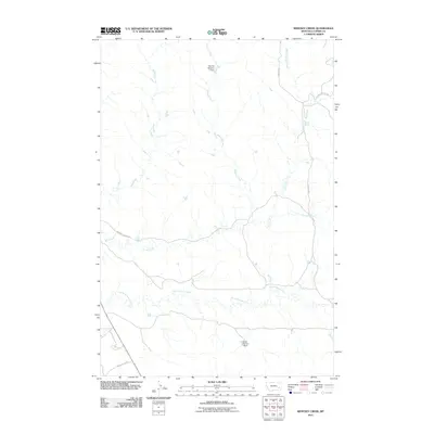
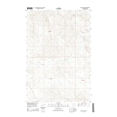
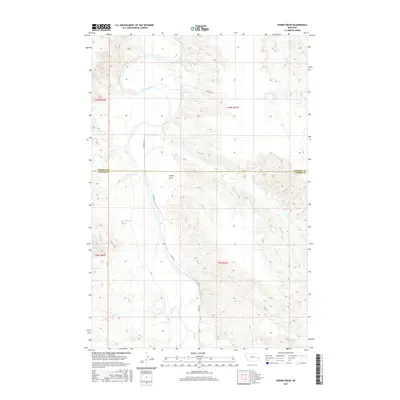
1965 Morehouse Creek
Custer County, MT
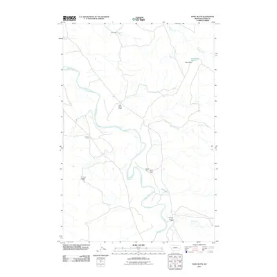
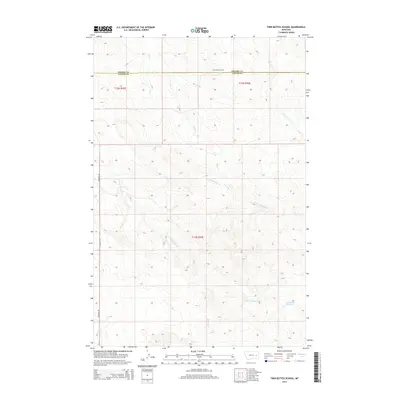
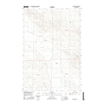
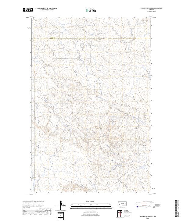
1965 Twin Buttes School
Custer County, MT
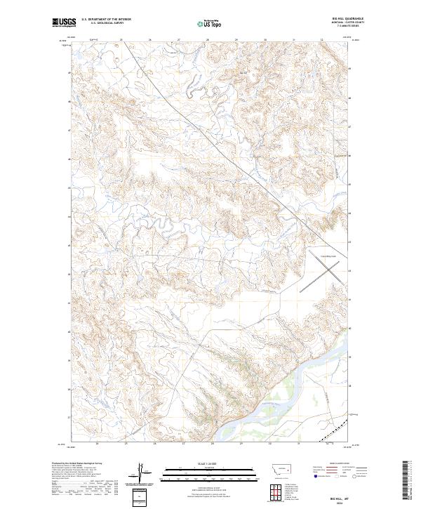
1968 Big Hill
Custer County, MT
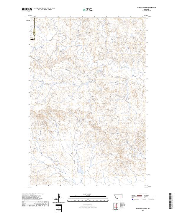
1968 Butterfly Creek
Custer County, MT
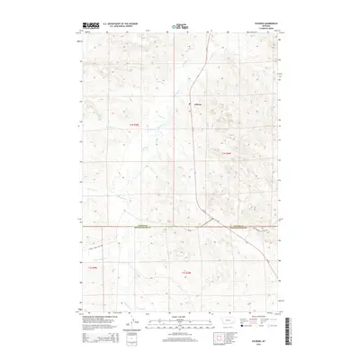
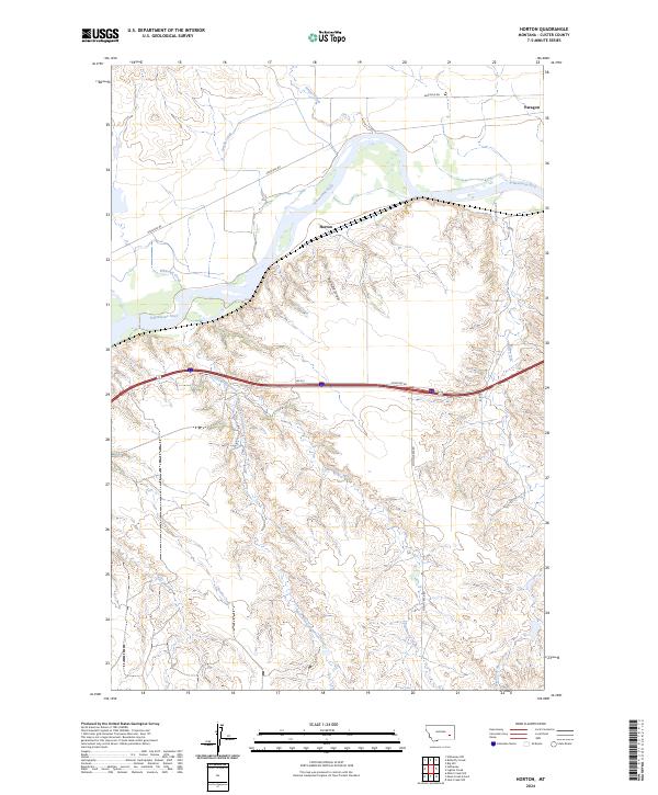
1968 Horton
Custer County, MT
1968 Lignite Creek
Custer County, MT
1968 Paddy Fay Creek
Custer County, MT
1969 Angela NE
Custer County, MT
1969 Bear Jaw Creek
Custer County, MT
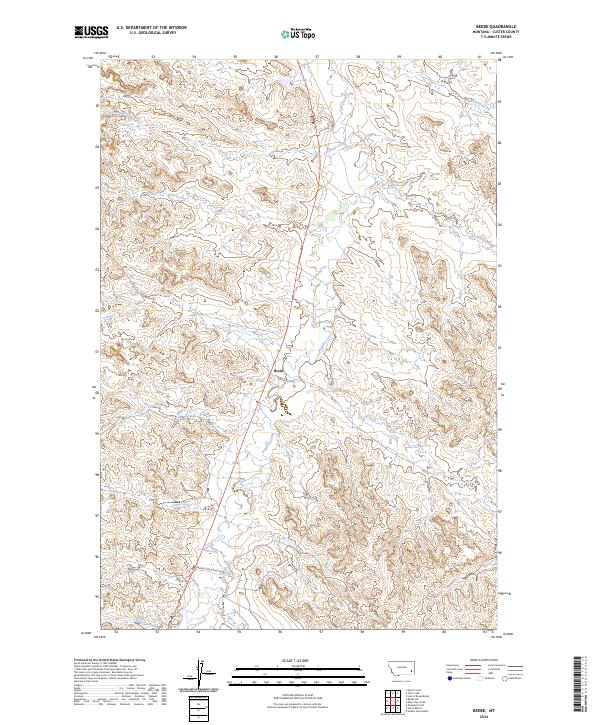
1969 Beebe
Custer County, MT
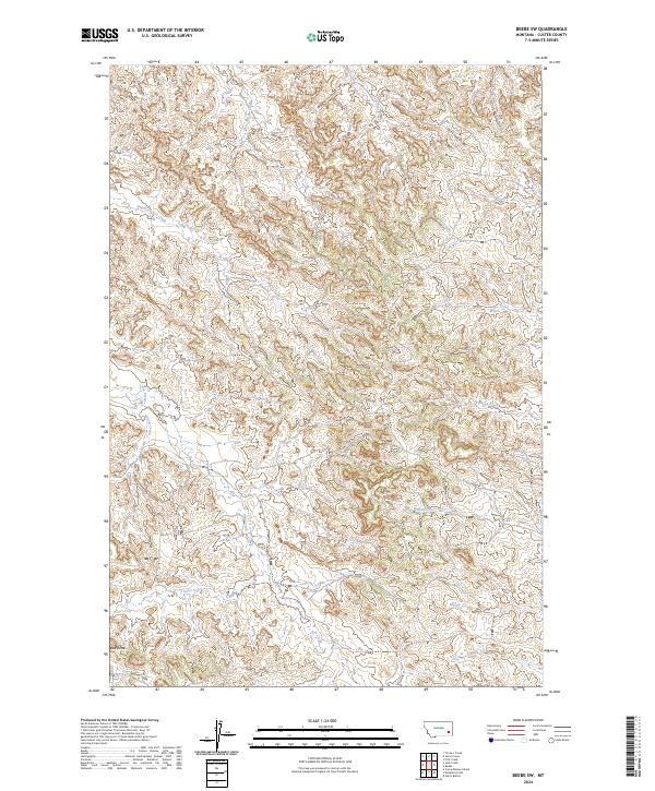
1969 Beebe SW
Custer County, MT
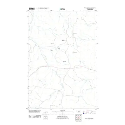
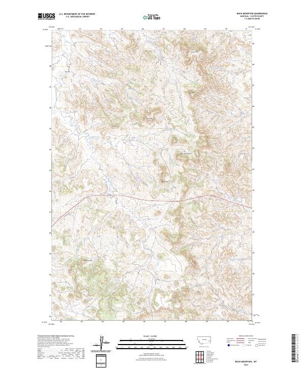
1969 Buck Mountain
Custer County, MT
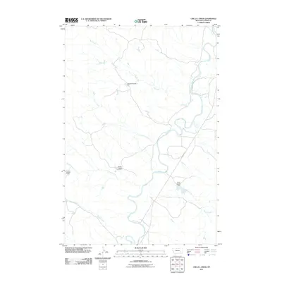
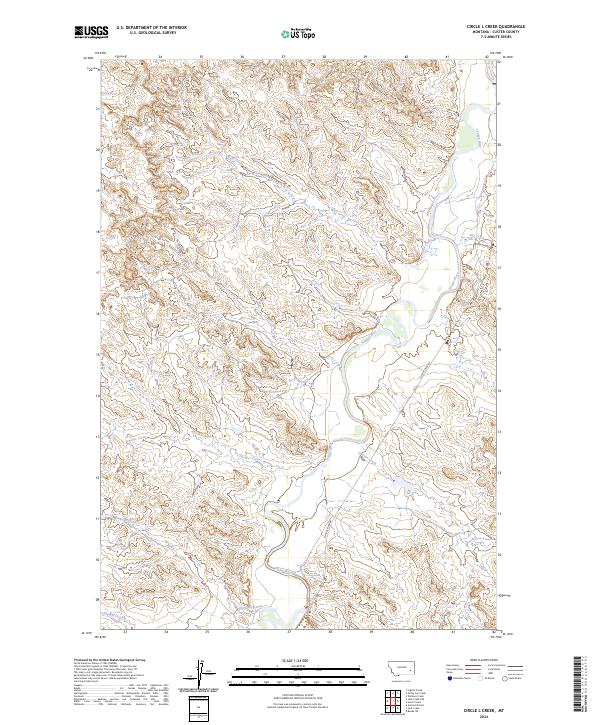
1969 Circle L Creek
Custer County, MT
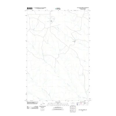
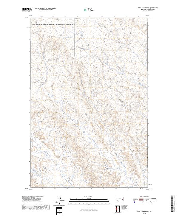
1969 Coal Bank Spring
Custer County, MT
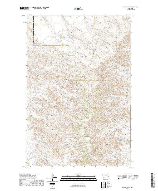
1969 Corral Butte
Custer County, MT
1969 Deadman Creek
Custer County, MT
1969 First Creek
Custer County, MT
1969 Forty Creek
Custer County, MT
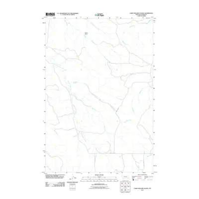
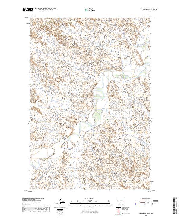
1969 Garland School
Custer County, MT
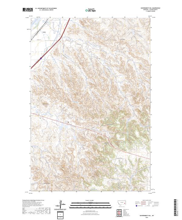
1969 Government Hill
Custer County, MT
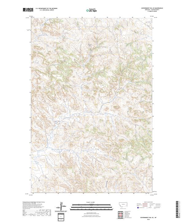
1969 Government Hill SE
Custer County, MT
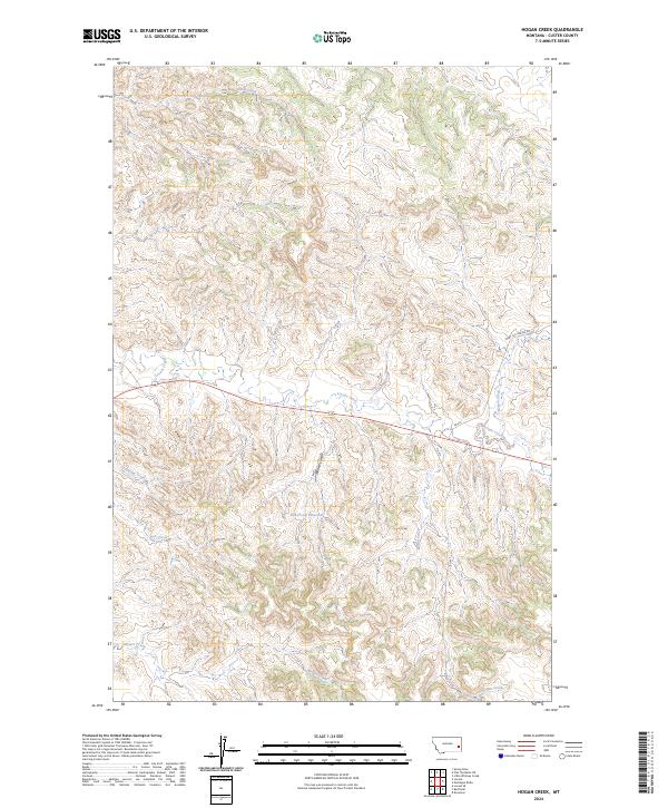
1969 Hogan Creek
Custer County, MT
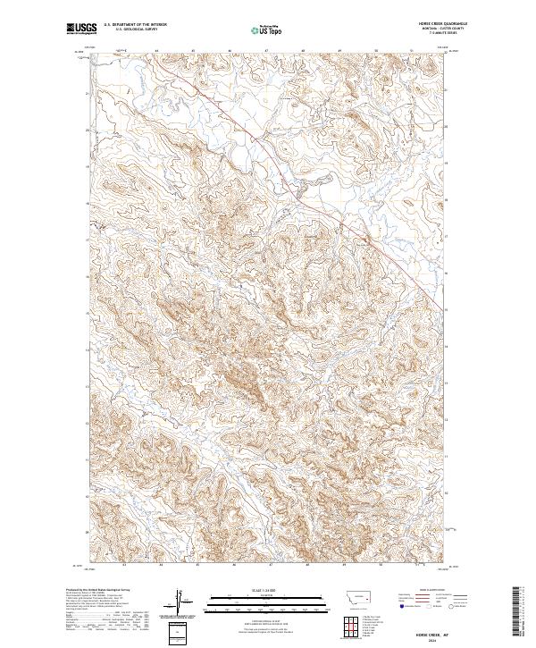
1969 Horse Creek
Custer County, MT
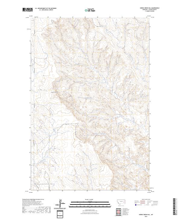
1969 Horse Creek Hill
Custer County, MT
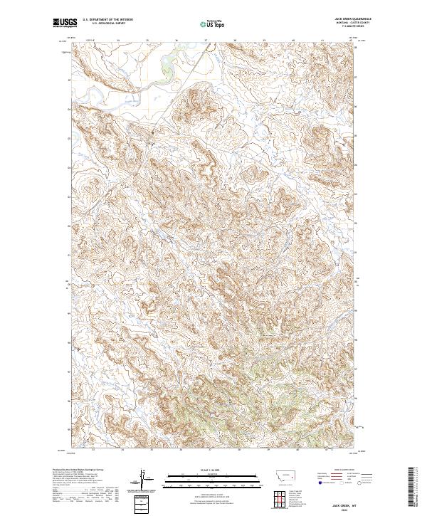
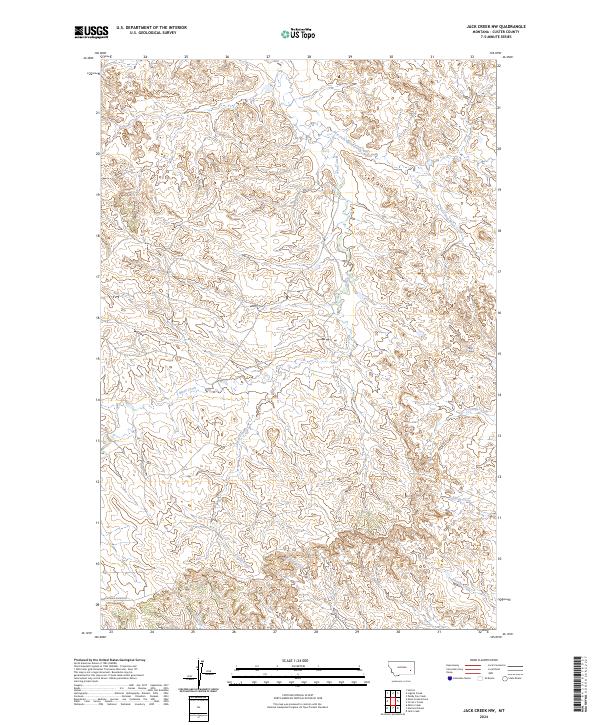
1969 Jack Creek
Custer County, MT
1969 Jack Creek NW
Custer County, MT
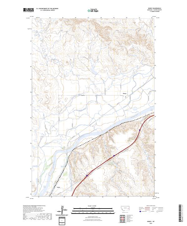
1969 Kinsey
Custer County, MT
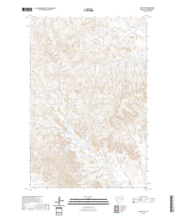
1969 Kinsey NE
Custer County, MT
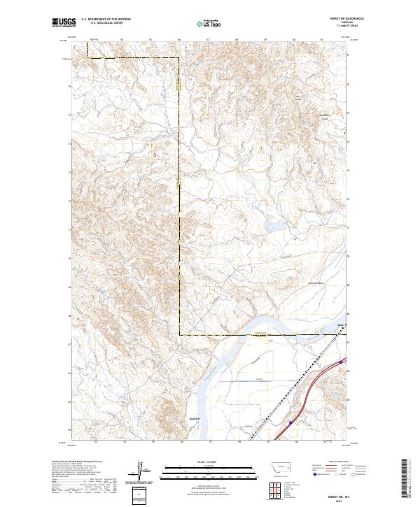
1969 Kinsey NW
Custer County, MT
1969 Knowlton
Custer County, MT
1969 Loaf of Bread Butte
Custer County, MT
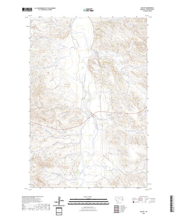
1969 Locate
Custer County, MT
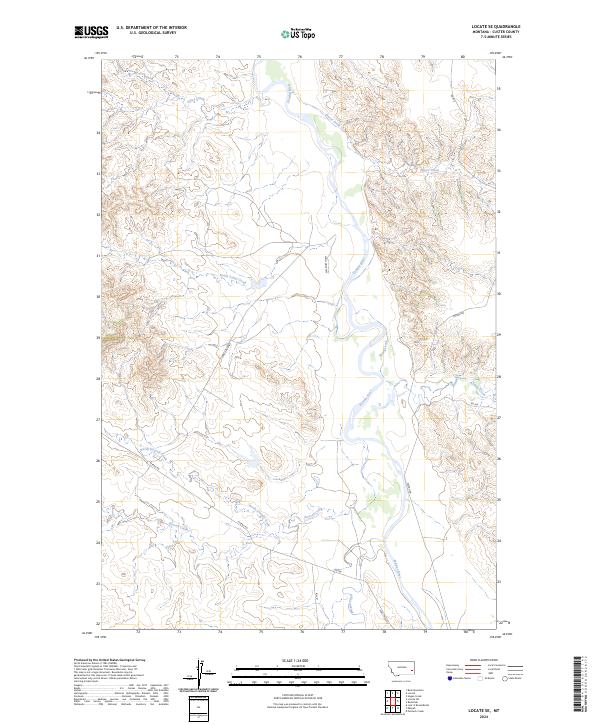
1969 Locate SE
Custer County, MT
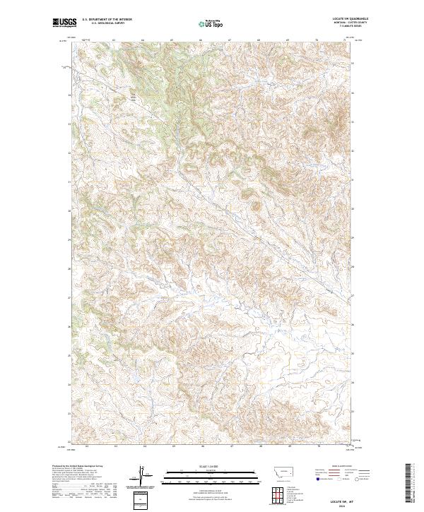
1969 Locate SW
Custer County, MT
1969 Miles City Creek
Custer County, MT
1969 Miller Creek
Custer County, MT
1969 Miller Creek SW
Custer County, MT
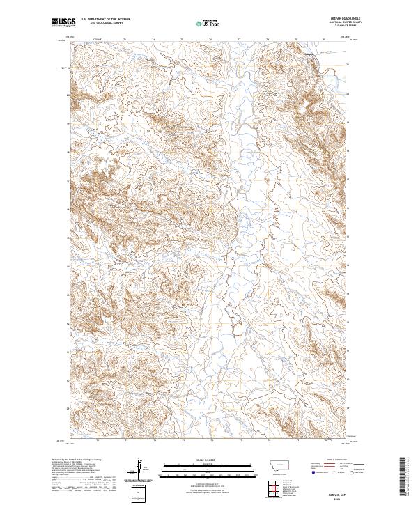
1969 Mizpah
Custer County, MT
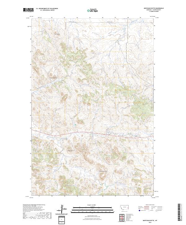
1969 Montague Butte
Custer County, MT
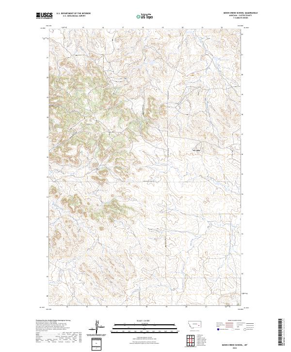
1969 Moon Creek School
Custer County, MT
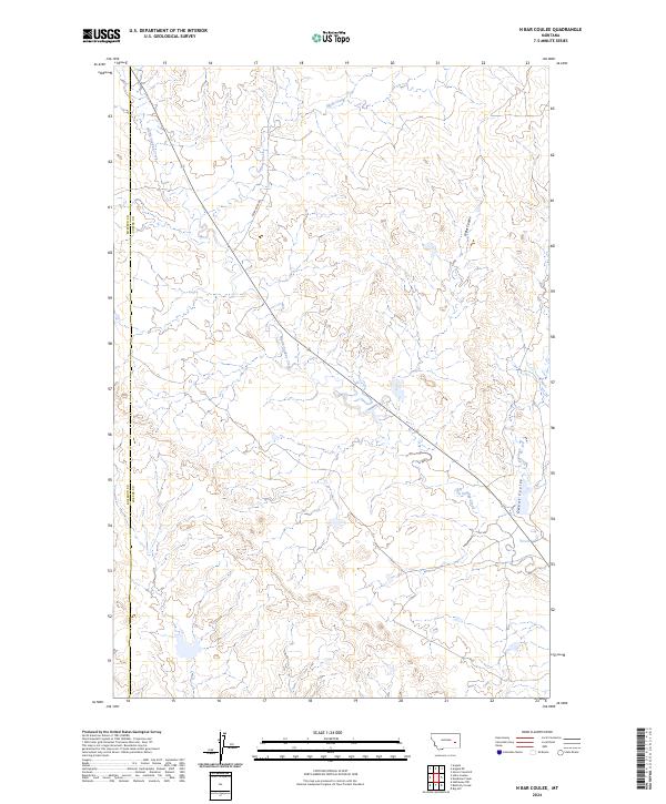
1969 N Bar Coulee
Custer County, MT
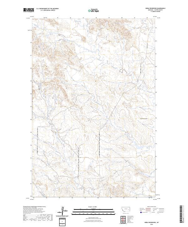
1969 Noble Reservoir
Custer County, MT
1969 Pennock Creek
Custer County, MT
1969 Red Knob
Custer County, MT
1969 Shirley
Custer County, MT
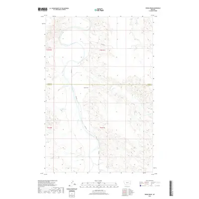
1969 Spring Draw
Custer County, MT
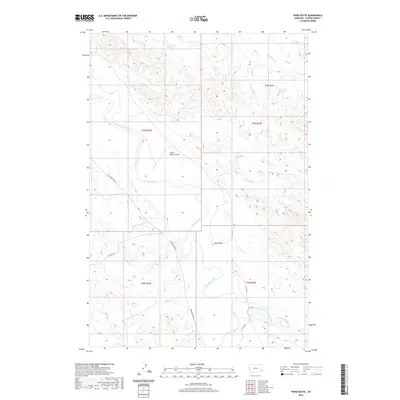
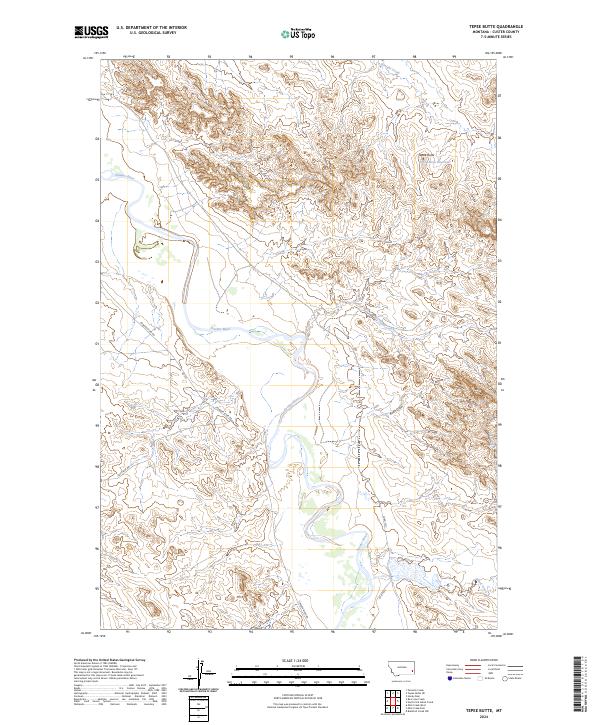
1969 Tepee Butte
Custer County, MT
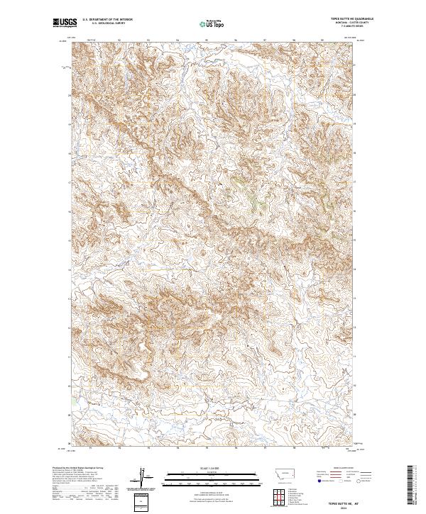
1969 Tepee Butte NE
Custer County, MT
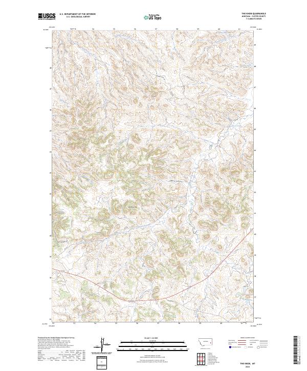
1969 The Knob
Custer County, MT
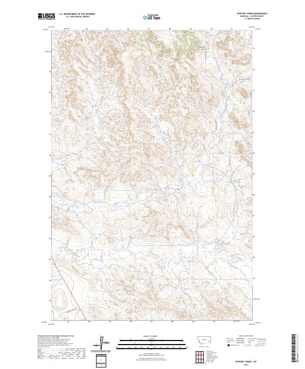
1969 Whitney Creek
Custer County, MT
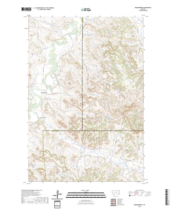
1971 Brandenberg
Custer County, MT
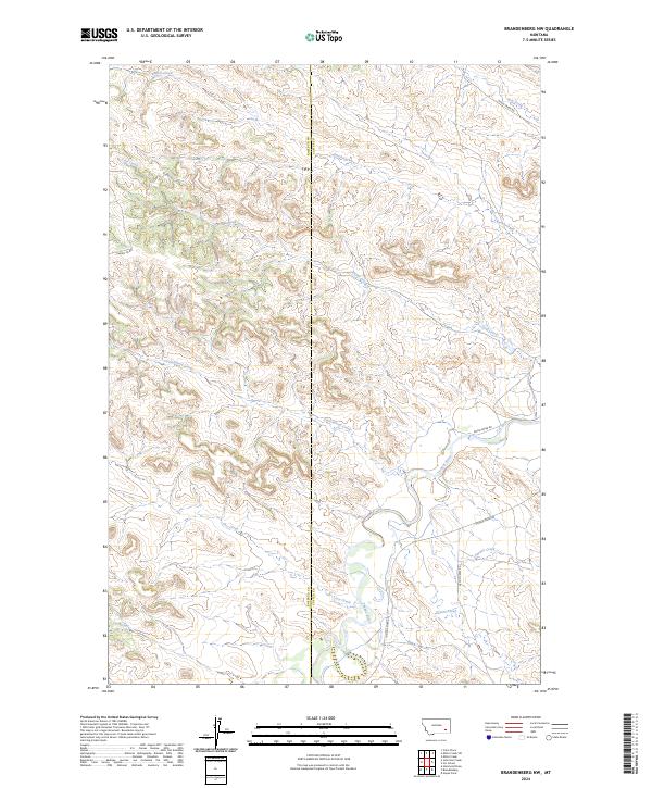
1971 Brandenberg NW
Custer County, MT
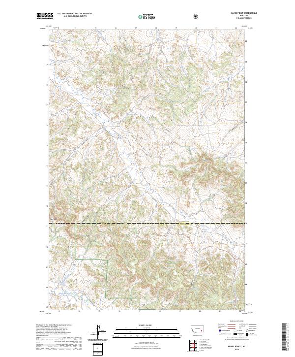
1971 Hayes Point
Custer County, MT
1971 HS School
Custer County, MT
1972 Physic Creek
Custer County, MT
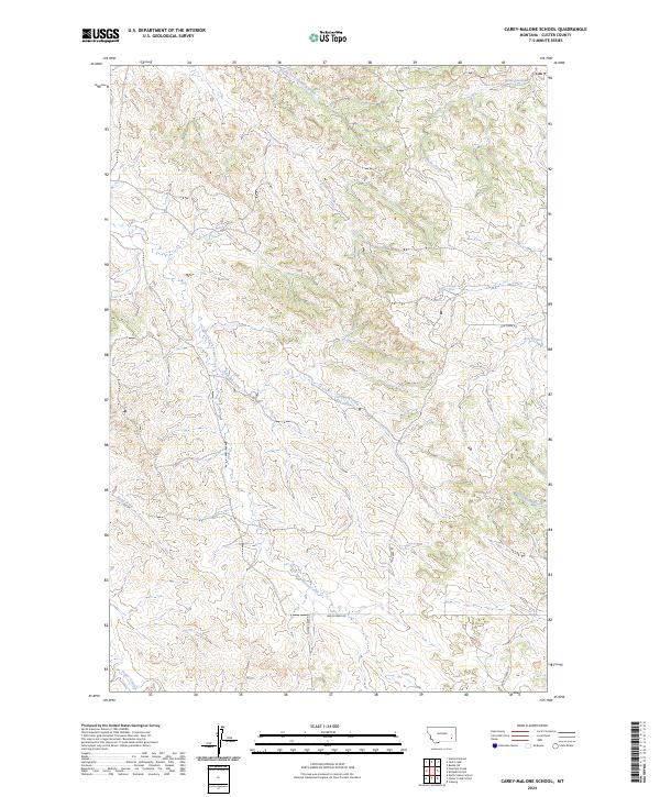
1973 Carey-Malone School
Custer County, MT
1973 Divide School
Custer County, MT
1973 Foster Creek School
Custer County, MT
1973 Fourmile Creek
Custer County, MT
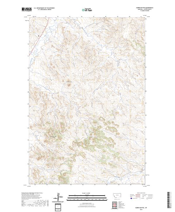
1973 Harris Buttes
Custer County, MT
1973 Kirkpatrick Hill
Custer County, MT
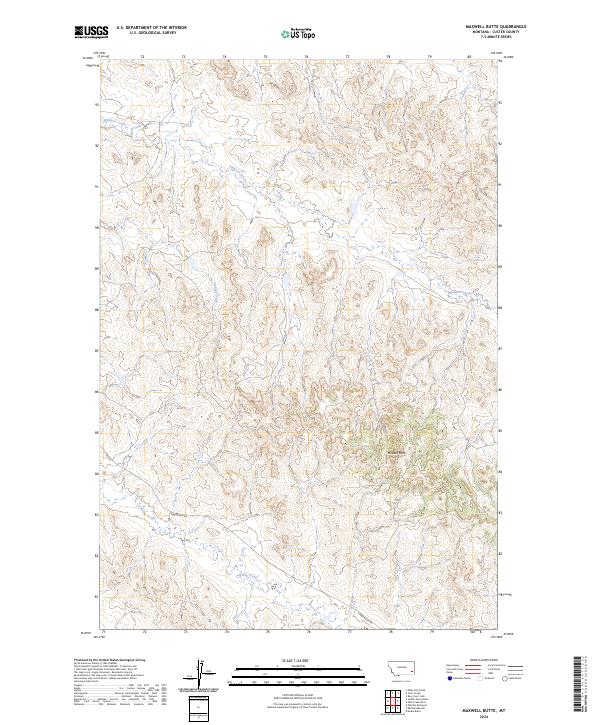
1973 Maxwell Butte
Custer County, MT

1973 North Stacey School
Custer County, MT
1973 Rattlesnake Hill
Custer County, MT
1973 Saddle Horse Butte
Custer County, MT
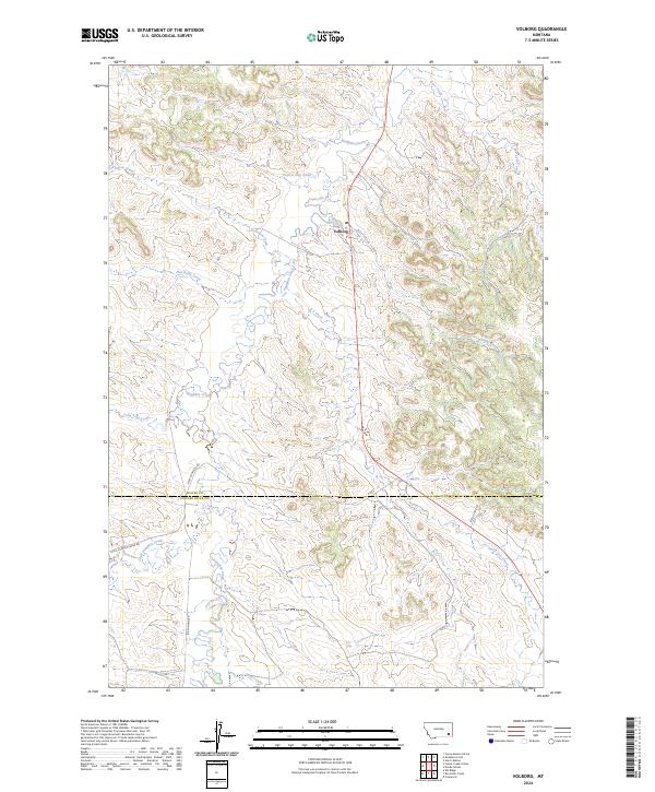
1973 Volborg
Custer County, MT
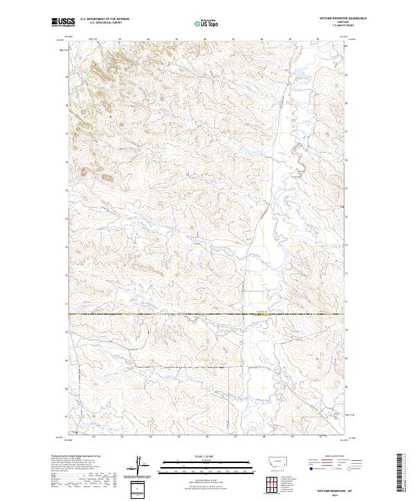
1973 Witcher Reservoir
Custer County, MT
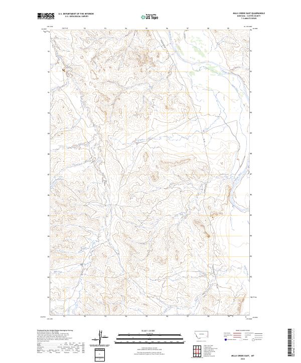
1979 Mills Creek East
Custer County, MT
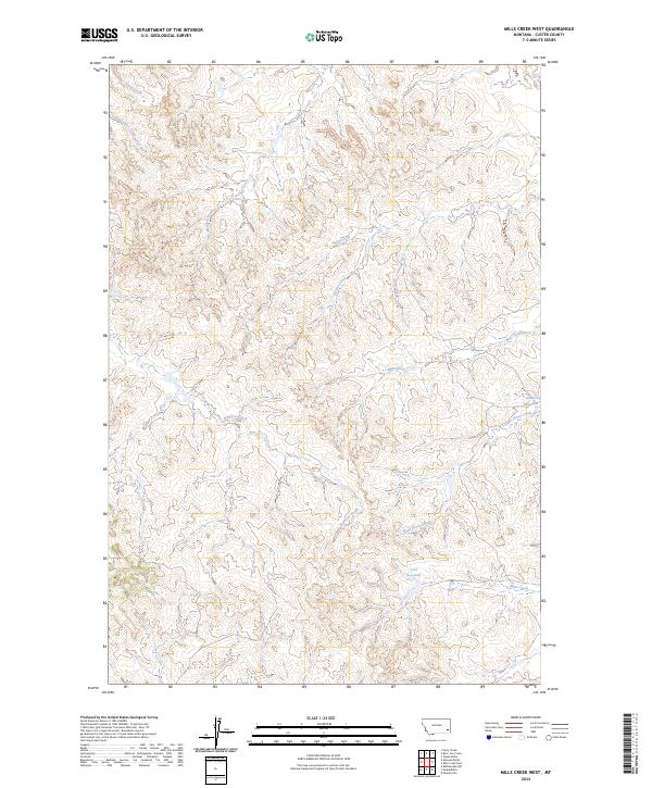
1979 Mills Creek West
Custer County, MT
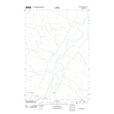
1979 Powderville
Custer County, MT
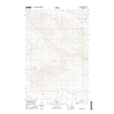
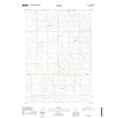
1979 Snake Butte
Custer County, MT
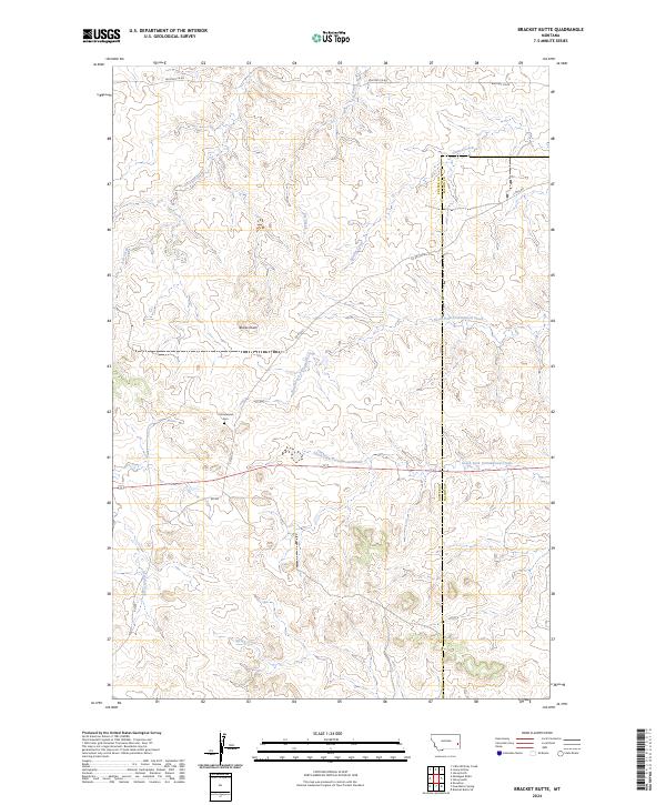
1981 Bracket Butte
Custer County, MT
1981 Foundation Spring
Custer County, MT
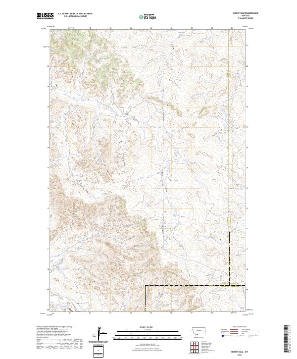
1981 Hooky Dam
Custer County, MT
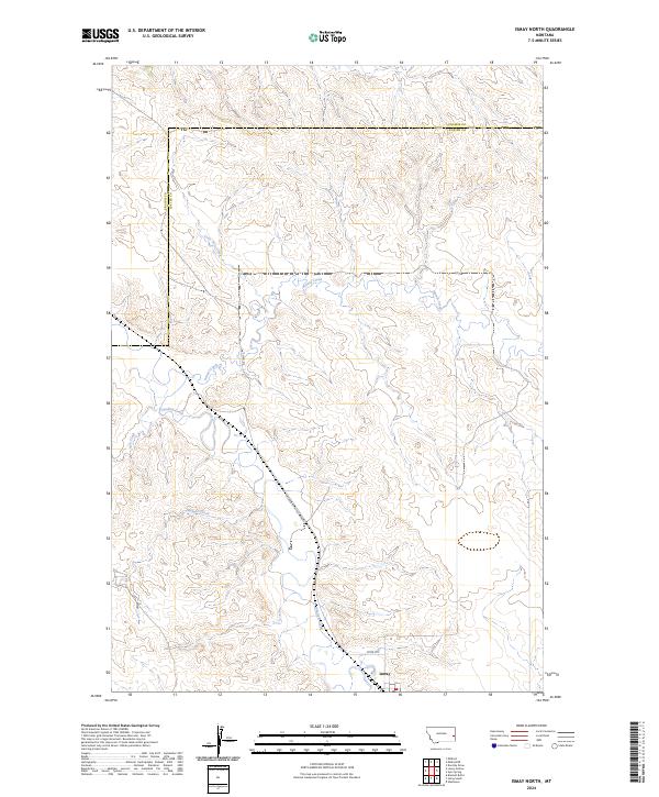
1981 Ismay North
Custer County, MT
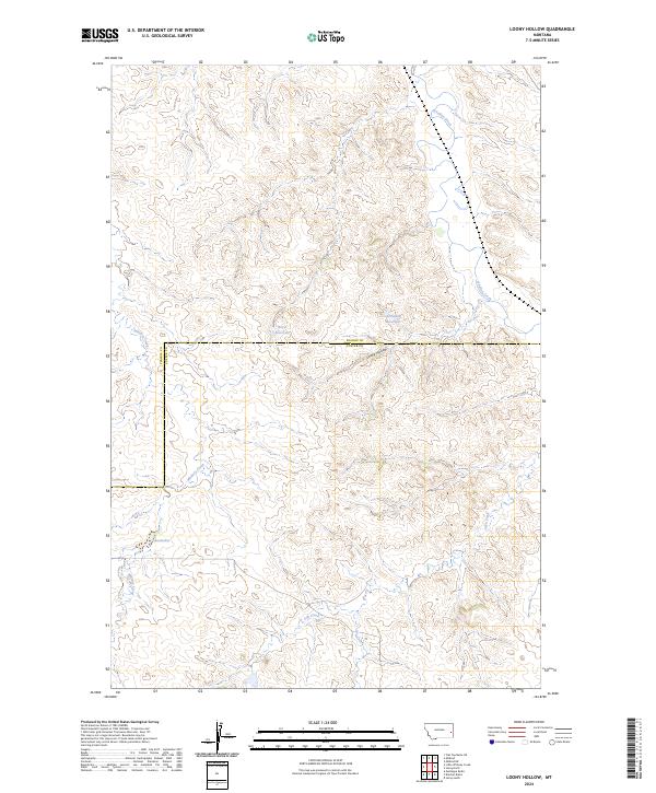
1981 Loony Hollow
Custer County, MT
1995 Hayes Point
Custer County, MT
1995 North Stacey School
Custer County, MT

2011 Angela NE
Custer County, MT

2011 Bear Jaw Creek
Custer County, MT
2011 Beebe
Custer County, MT
2011 Beebe SW
Custer County, MT
2011 Big Hill
Custer County, MT
2011 Bracket Butte
Custer County, MT
2011 Brandenberg
Custer County, MT
2011 Brandenberg NW
Custer County, MT
2011 Buck Mountain
Custer County, MT

2011 Butterfly Creek
Custer County, MT
2011 Carey-Malone School
Custer County, MT
2011 Circle L Creek
Custer County, MT
2011 Coal Bank Spring
Custer County, MT
2011 Corral Butte
Custer County, MT
2011 Crow Rock SE
Custer County, MT
2011 Deadman Creek
Custer County, MT
2011 Divide School
Custer County, MT
2011 First Creek
Custer County, MT
2011 Forty Creek
Custer County, MT
2011 Foster Creek School
Custer County, MT
2011 Foundation Spring
Custer County, MT
2011 Fourmile Creek
Custer County, MT
2011 Garland School
Custer County, MT
2011 Government Hill
Custer County, MT
2011 Government Hill SE
Custer County, MT
2011 Harris Buttes
Custer County, MT
2011 Hayes Point
Custer County, MT
2011 Hogan Creek
Custer County, MT
2011 Hooky Dam
Custer County, MT
2011 Horse Creek
Custer County, MT
2011 Horse Creek Hill
Custer County, MT
2011 Horton
Custer County, MT
2011 Ismay North
Custer County, MT
2011 Jack Creek
Custer County, MT
2011 Jack Creek NW
Custer County, MT
2011 Kinsey
Custer County, MT
2011 Kinsey NE
Custer County, MT
2011 Kinsey NW
Custer County, MT
2011 Kirkpatrick Hill
Custer County, MT
2011 Knowlton
Custer County, MT
2011 Lignite Creek
Custer County, MT
2011 Loaf of Bread Butte
Custer County, MT
2011 Locate
Custer County, MT
2011 Locate SE
Custer County, MT
2011 Locate SW
Custer County, MT
2011 Loony Hollow
Custer County, MT
2011 Maxwell Butte
Custer County, MT
2011 Miles City Creek
Custer County, MT
2011 Miller Creek
Custer County, MT
2011 Miller Creek SW
Custer County, MT
2011 Mills Creek East
Custer County, MT
2011 Mills Creek West
Custer County, MT
2011 Mizpah
Custer County, MT
2011 Montague Butte
Custer County, MT
2011 Moon Creek School
Custer County, MT
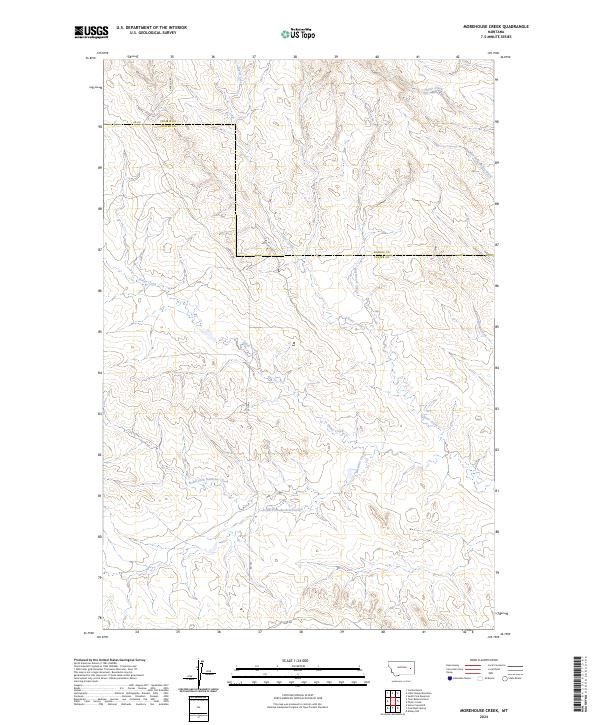
2011 Morehouse Creek
Custer County, MT

2011 N Bar Coulee
Custer County, MT
2011 Noble Reservoir
Custer County, MT
2011 North Stacey School
Custer County, MT
2011 Paddy Fay Creek
Custer County, MT
2011 Pennock Creek
Custer County, MT
2011 Physic Creek
Custer County, MT
2011 Powderville
Custer County, MT
2011 Rattlesnake Hill
Custer County, MT
2011 Red Knob
Custer County, MT
2011 Saddle Horse Butte
Custer County, MT
2011 Shirley
Custer County, MT
2011 S H School
Custer County, MT
2011 Snake Butte
Custer County, MT
2011 Spring Draw
Custer County, MT
2011 Tepee Butte
Custer County, MT
2011 Tepee Butte NE
Custer County, MT
2011 The Knob
Custer County, MT
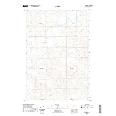
2011 Twin Buttes School
Custer County, MT
2011 Volborg
Custer County, MT
2011 Whitney Creek
Custer County, MT
2011 Witcher Reservoir
Custer County, MT
2014 Angela NE
Custer County, MT
2014 Bear Jaw Creek
Custer County, MT
2014 Beebe
Custer County, MT
2014 Beebe SW
Custer County, MT
2014 Big Hill
Custer County, MT
2014 Bracket Butte
Custer County, MT
2014 Brandenberg
Custer County, MT
2014 Brandenberg NW
Custer County, MT
2014 Buck Mountain
Custer County, MT
2014 Butterfly Creek
Custer County, MT
2014 Carey-Malone School
Custer County, MT
2014 Circle L Creek
Custer County, MT
2014 Coal Bank Spring
Custer County, MT
2014 Corral Butte
Custer County, MT
2014 Crow Rock SE
Custer County, MT
2014 Deadman Creek
Custer County, MT
2014 Divide School
Custer County, MT

2014 First Creek
Custer County, MT
2014 Forty Creek
Custer County, MT
2014 Foster Creek School
Custer County, MT
2014 Foundation Spring
Custer County, MT
2014 Fourmile Creek
Custer County, MT
2014 Garland School
Custer County, MT
2014 Government Hill
Custer County, MT
2014 Government Hill SE
Custer County, MT
2014 Harris Buttes
Custer County, MT
2014 Hayes Point
Custer County, MT
2014 Hogan Creek
Custer County, MT
2014 Hooky Dam
Custer County, MT
2014 Horse Creek
Custer County, MT
2014 Horse Creek Hill
Custer County, MT
2014 Horton
Custer County, MT
2014 Ismay North
Custer County, MT
2014 Jack Creek
Custer County, MT

2014 Jack Creek NW
Custer County, MT
2014 Kinsey
Custer County, MT
2014 Kinsey NE
Custer County, MT
2014 Kinsey NW
Custer County, MT
2014 Kirkpatrick Hill
Custer County, MT
2014 Knowlton
Custer County, MT
2014 Lignite Creek
Custer County, MT

2014 Loaf of Bread Butte
Custer County, MT
2014 Locate
Custer County, MT

2014 Locate SE
Custer County, MT
2014 Locate SW
Custer County, MT
2014 Loony Hollow
Custer County, MT
2014 Maxwell Butte
Custer County, MT
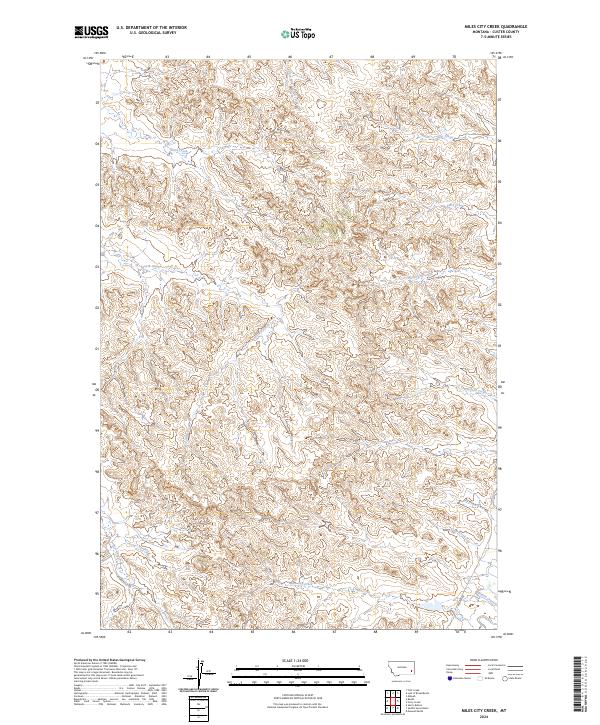
2014 Miles City Creek
Custer County, MT
2014 Miller Creek
Custer County, MT
2014 Miller Creek SW
Custer County, MT
2014 Mills Creek East
Custer County, MT
2014 Mills Creek West
Custer County, MT
2014 Mizpah
Custer County, MT
2014 Montague Butte
Custer County, MT
2014 Moon Creek School
Custer County, MT
2014 Morehouse Creek
Custer County, MT
2014 N Bar Coulee
Custer County, MT
2014 Noble Reservoir
Custer County, MT
2014 North Stacey School
Custer County, MT
2014 Paddy Fay Creek
Custer County, MT
2014 Pennock Creek
Custer County, MT
2014 Physic Creek
Custer County, MT
2014 Powderville
Custer County, MT
2014 Rattlesnake Hill
Custer County, MT
2014 Red Knob
Custer County, MT
2014 Saddle Horse Butte
Custer County, MT
2014 Shirley
Custer County, MT
2014 S H School
Custer County, MT
2014 Snake Butte
Custer County, MT
2014 Spring Draw
Custer County, MT
2014 Tepee Butte
Custer County, MT
2014 Tepee Butte NE
Custer County, MT
2014 The Knob
Custer County, MT
2014 Twin Buttes School
Custer County, MT
2014 Volborg
Custer County, MT
2014 Whitney Creek
Custer County, MT
2014 Witcher Reservoir
Custer County, MT
2017 Angela NE
Custer County, MT
2017 Bear Jaw Creek
Custer County, MT
2017 Beebe
Custer County, MT
2017 Beebe SW
Custer County, MT
2017 Big Hill
Custer County, MT
2017 Bracket Butte
Custer County, MT
2017 Brandenberg
Custer County, MT

2017 Brandenberg NW
Custer County, MT
2017 Buck Mountain
Custer County, MT
2017 Butterfly Creek
Custer County, MT
2017 Carey-Malone School
Custer County, MT
2017 Circle L Creek
Custer County, MT
2017 Coal Bank Spring
Custer County, MT
2017 Corral Butte
Custer County, MT
2017 Crow Rock SE
Custer County, MT
2017 Deadman Creek
Custer County, MT
2017 Divide School
Custer County, MT
2017 First Creek
Custer County, MT
2017 Forty Creek
Custer County, MT
2017 Foster Creek School
Custer County, MT
2017 Foundation Spring
Custer County, MT
2017 Fourmile Creek
Custer County, MT

2017 Garland School
Custer County, MT

2017 Government Hill
Custer County, MT
2017 Government Hill SE
Custer County, MT

2017 Harris Buttes
Custer County, MT
2017 Hayes Point
Custer County, MT
2017 Hogan Creek
Custer County, MT
2017 Hooky Dam
Custer County, MT
2017 Horse Creek
Custer County, MT
2017 Horse Creek Hill
Custer County, MT
2017 Horton
Custer County, MT
2017 Ismay North
Custer County, MT
2017 Jack Creek
Custer County, MT
2017 Jack Creek NW
Custer County, MT
2017 Kinsey
Custer County, MT
2017 Kinsey NE
Custer County, MT
2017 Kinsey NW
Custer County, MT
2017 Kirkpatrick Hill
Custer County, MT
2017 Knowlton
Custer County, MT
2017 Lignite Creek
Custer County, MT
2017 Loaf of Bread Butte
Custer County, MT
2017 Locate
Custer County, MT
2017 Locate SE
Custer County, MT
2017 Locate SW
Custer County, MT
2017 Loony Hollow
Custer County, MT
2017 Maxwell Butte
Custer County, MT
2017 Miles City Creek
Custer County, MT
2017 Miller Creek
Custer County, MT
2017 Miller Creek SW
Custer County, MT
2017 Mills Creek East
Custer County, MT
2017 Mills Creek West
Custer County, MT
2017 Mizpah
Custer County, MT
2017 Montague Butte
Custer County, MT
2017 Moon Creek School
Custer County, MT
2017 Morehouse Creek
Custer County, MT
2017 N Bar Coulee
Custer County, MT
2017 Noble Reservoir
Custer County, MT
2017 North Stacey School
Custer County, MT
2017 Paddy Fay Creek
Custer County, MT
2017 Pennock Creek
Custer County, MT
2017 Physic Creek
Custer County, MT
2017 Powderville
Custer County, MT
2017 Rattlesnake Hill
Custer County, MT
2017 Red Knob
Custer County, MT
2017 Saddle Horse Butte
Custer County, MT
2017 Shirley
Custer County, MT
2017 S H School
Custer County, MT
2017 Snake Butte
Custer County, MT
2017 Spring Draw
Custer County, MT
2017 Tepee Butte
Custer County, MT
2017 Tepee Butte NE
Custer County, MT
2017 The Knob
Custer County, MT
2017 Twin Buttes School
Custer County, MT
2017 Volborg
Custer County, MT
2017 Whitney Creek
Custer County, MT
2017 Witcher Reservoir
Custer County, MT
2020 Angela NE
Custer County, MT
2020 Bear Jaw Creek
Custer County, MT
2020 Beebe
Custer County, MT
2020 Beebe SW
Custer County, MT
2020 Big Hill
Custer County, MT
2020 Bracket Butte
Custer County, MT
2020 Brandenberg
Custer County, MT
2020 Brandenberg NW
Custer County, MT
2020 Buck Mountain
Custer County, MT
2020 Butterfly Creek
Custer County, MT
2020 Carey-Malone School
Custer County, MT
2020 Circle L Creek
Custer County, MT
2020 Coal Bank Spring
Custer County, MT
2020 Corral Butte
Custer County, MT
2020 Crow Rock SE
Custer County, MT
2020 Deadman Creek
Custer County, MT
2020 Divide School
Custer County, MT
2020 First Creek
Custer County, MT
2020 Forty Creek
Custer County, MT
2020 Foster Creek School
Custer County, MT
2020 Foundation Spring
Custer County, MT
2020 Fourmile Creek
Custer County, MT
2020 Garland School
Custer County, MT
2020 Government Hill
Custer County, MT
2020 Government Hill SE
Custer County, MT
2020 Harris Buttes
Custer County, MT
2020 Hayes Point
Custer County, MT
2020 Hogan Creek
Custer County, MT
2020 Hooky Dam
Custer County, MT
2020 Horse Creek
Custer County, MT
2020 Horse Creek Hill
Custer County, MT
2020 Horton
Custer County, MT
2020 Ismay North
Custer County, MT
2020 Jack Creek
Custer County, MT
2020 Jack Creek NW
Custer County, MT
2020 Kinsey
Custer County, MT
2020 Kinsey NE
Custer County, MT
2020 Kinsey NW
Custer County, MT
2020 Kirkpatrick Hill
Custer County, MT
2020 Knowlton
Custer County, MT
2020 Lignite Creek
Custer County, MT
2020 Loaf of Bread Butte
Custer County, MT
2020 Locate
Custer County, MT
2020 Locate SE
Custer County, MT
2020 Locate SW
Custer County, MT
2020 Loony Hollow
Custer County, MT
2020 Maxwell Butte
Custer County, MT
2020 Miles City Creek
Custer County, MT
2020 Miller Creek
Custer County, MT
2020 Miller Creek SW
Custer County, MT
2020 Mills Creek East
Custer County, MT
2020 Mills Creek West
Custer County, MT
2020 Mizpah
Custer County, MT
2020 Montague Butte
Custer County, MT
2020 Moon Creek School
Custer County, MT
2020 Morehouse Creek
Custer County, MT
2020 N Bar Coulee
Custer County, MT
2020 Noble Reservoir
Custer County, MT
2020 North Stacey School
Custer County, MT
2020 Paddy Fay Creek
Custer County, MT
2020 Pennock Creek
Custer County, MT
2020 Physic Creek
Custer County, MT
2020 Powderville
Custer County, MT
2020 Rattlesnake Hill
Custer County, MT
2020 Red Knob
Custer County, MT
2020 Saddle Horse Butte
Custer County, MT
2020 Shirley
Custer County, MT
2020 S H School
Custer County, MT
2020 Snake Butte
Custer County, MT
2020 Spring Draw
Custer County, MT
2020 Tepee Butte
Custer County, MT
2020 Tepee Butte NE
Custer County, MT
2020 The Knob
Custer County, MT
2020 Twin Buttes School
Custer County, MT
2020 Volborg
Custer County, MT
2020 Whitney Creek
Custer County, MT
2020 Witcher Reservoir
Custer County, MT
2024 Angela NE
Custer County, MT
2024 Bear Jaw Creek
Custer County, MT
2024 Beebe
Custer County, MT
2024 Beebe SW
Custer County, MT
2024 Big Hill
Custer County, MT
2024 Bracket Butte
Custer County, MT
2024 Brandenberg
Custer County, MT
2024 Brandenberg NW
Custer County, MT
2024 Buck Mountain
Custer County, MT
2024 Butterfly Creek
Custer County, MT
2024 Carey-Malone School
Custer County, MT
2024 Circle L Creek
Custer County, MT
2024 Coal Bank Spring
Custer County, MT
2024 Corral Butte
Custer County, MT
2024 Crow Rock SE
Custer County, MT
2024 Deadman Creek
Custer County, MT
2024 Divide School
Custer County, MT
2024 First Creek
Custer County, MT
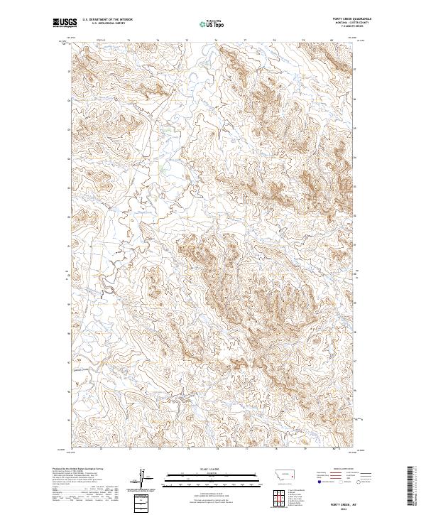
2024 Forty Creek
Custer County, MT
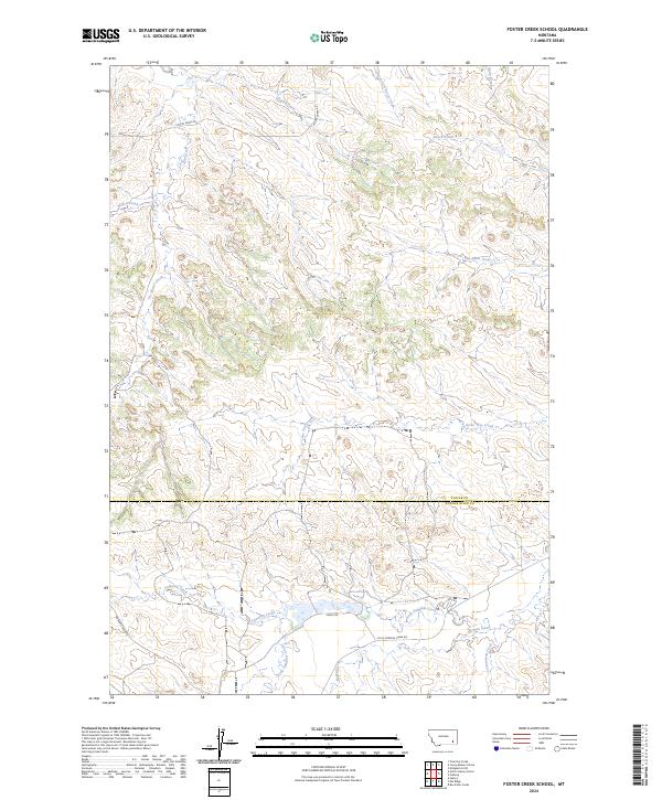
2024 Foster Creek School
Custer County, MT
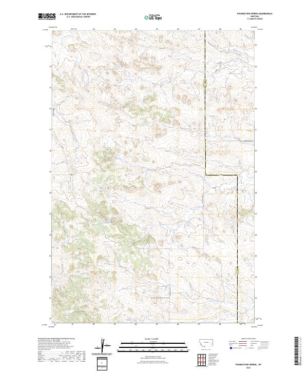
2024 Foundation Spring
Custer County, MT
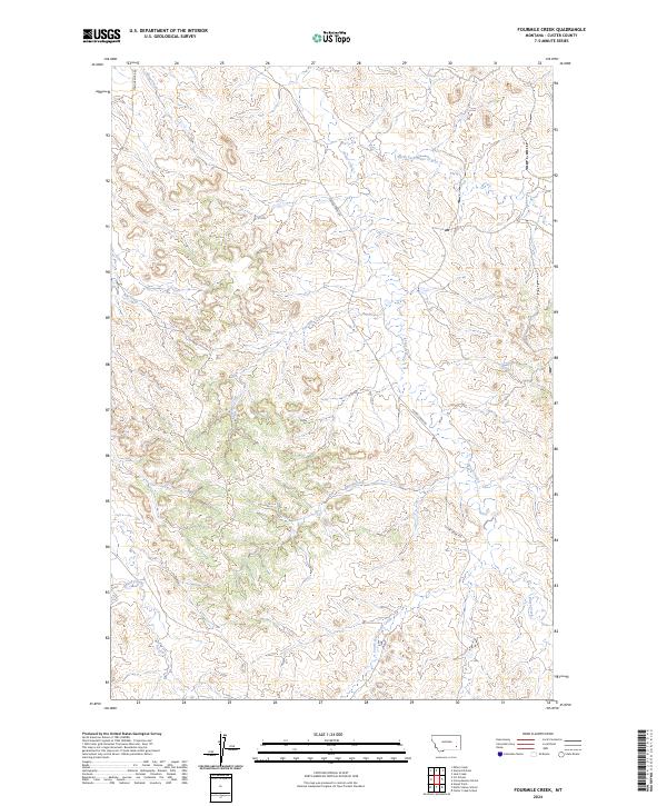
2024 Fourmile Creek
Custer County, MT
2024 Garland School
Custer County, MT
2024 Government Hill
Custer County, MT
2024 Government Hill SE
Custer County, MT
2024 Harris Buttes
Custer County, MT
2024 Hayes Point
Custer County, MT
2024 Hogan Creek
Custer County, MT
2024 Hooky Dam
Custer County, MT
2024 Horse Creek
Custer County, MT
2024 Horse Creek Hill
Custer County, MT
2024 Horton
Custer County, MT
2024 Ismay North
Custer County, MT
2024 Jack Creek
Custer County, MT
2024 Jack Creek NW
Custer County, MT
2024 Kinsey
Custer County, MT
2024 Kinsey NE
Custer County, MT
2024 Kinsey NW
Custer County, MT
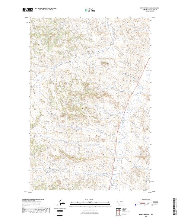
2024 Kirkpatrick Hill
Custer County, MT
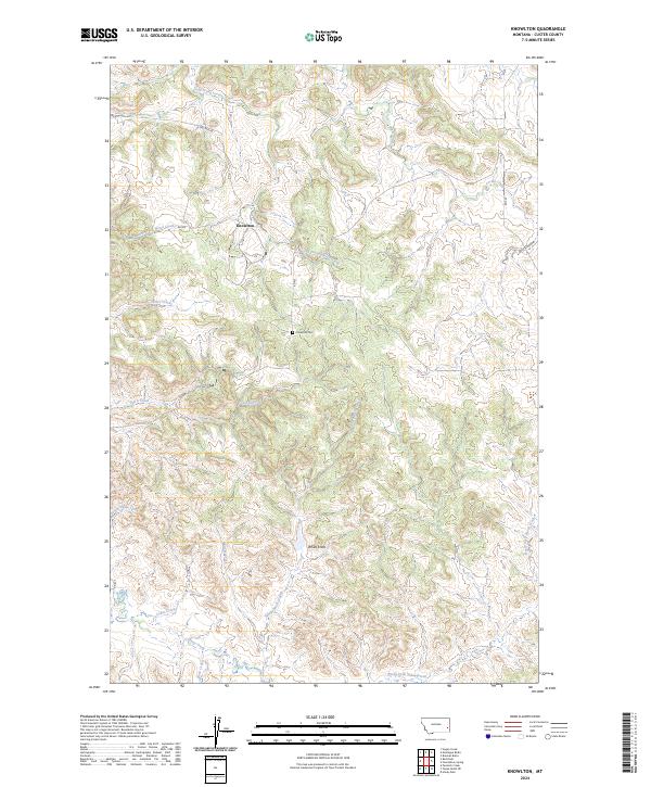
2024 Knowlton
Custer County, MT
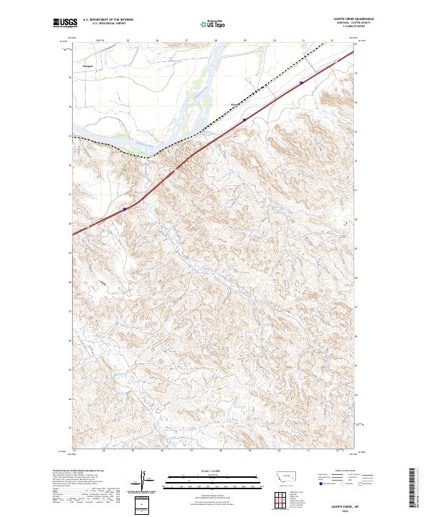
2024 Lignite Creek
Custer County, MT
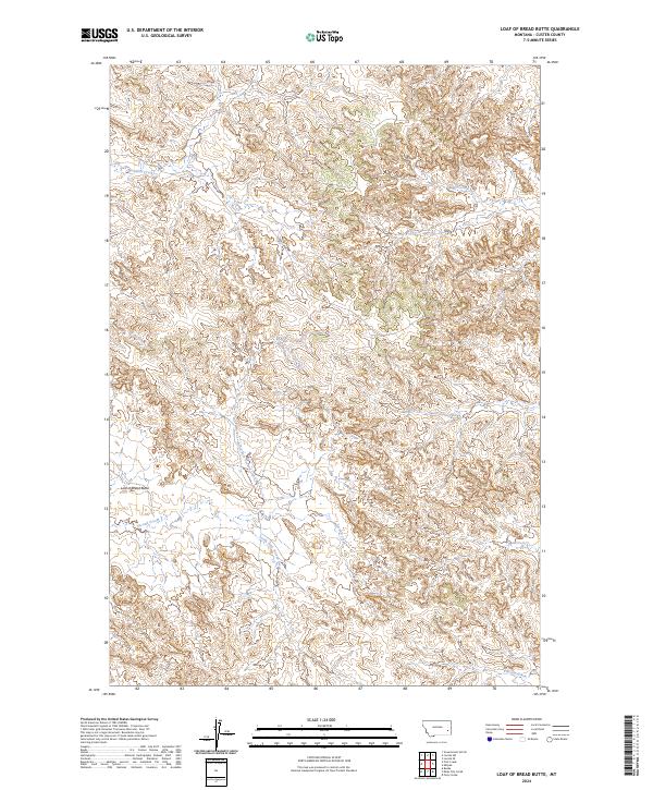
2024 Loaf of Bread Butte
Custer County, MT
2024 Locate
Custer County, MT
2024 Locate SE
Custer County, MT
2024 Locate SW
Custer County, MT
2024 Loony Hollow
Custer County, MT
2024 Maxwell Butte
Custer County, MT
2024 Miles City Creek
Custer County, MT
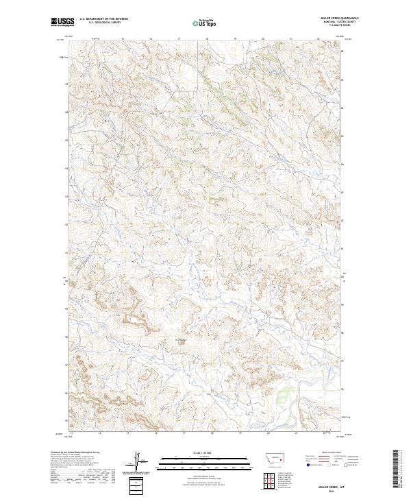
2024 Miller Creek
Custer County, MT
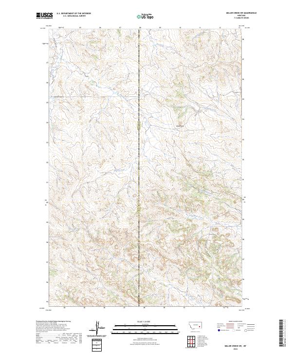
2024 Miller Creek SW
Custer County, MT
2024 Mills Creek East
Custer County, MT
2024 Mills Creek West
Custer County, MT
2024 Mizpah
Custer County, MT
2024 Montague Butte
Custer County, MT
2024 Moon Creek School
Custer County, MT
2024 Morehouse Creek
Custer County, MT
2024 N Bar Coulee
Custer County, MT
2024 Noble Reservoir
Custer County, MT
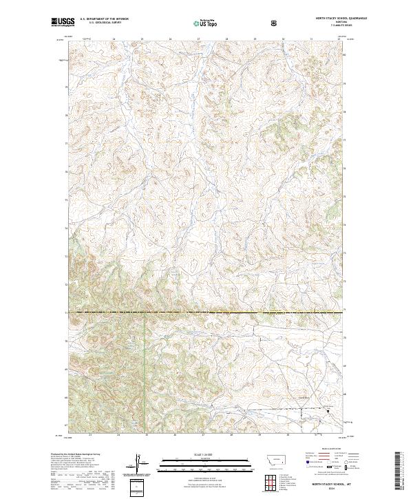
2024 North Stacey School
Custer County, MT
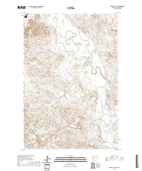
2024 Paddy Fay Creek
Custer County, MT
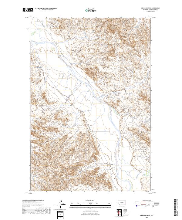
2024 Pennock Creek
Custer County, MT
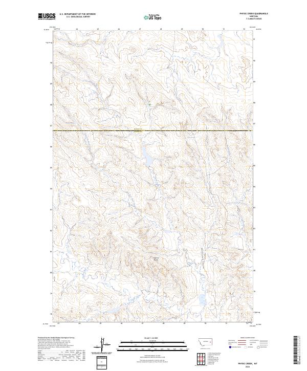
2024 Physic Creek
Custer County, MT
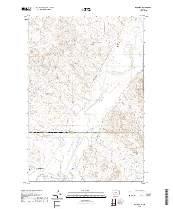
2024 Powderville
Custer County, MT
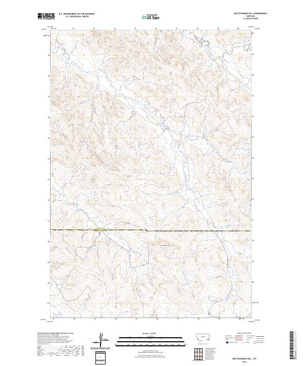
2024 Rattlesnake Hill
Custer County, MT
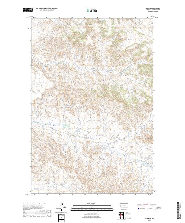
2024 Red Knob
Custer County, MT
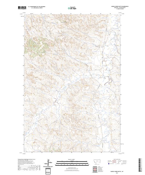
2024 Saddle Horse Butte
Custer County, MT
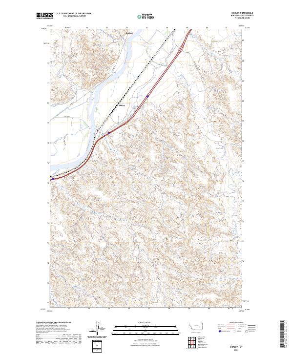
2024 Shirley
Custer County, MT
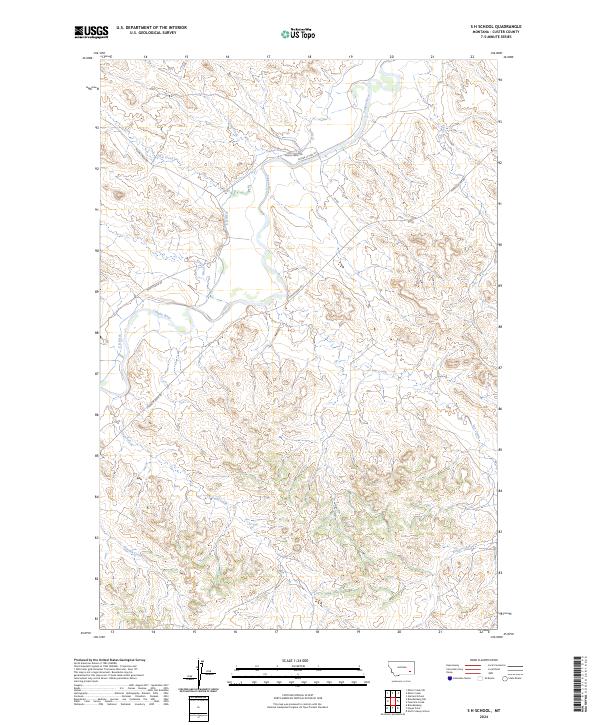
2024 S H School
Custer County, MT
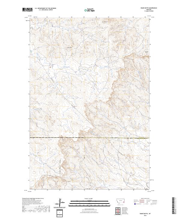
2024 Snake Butte
Custer County, MT
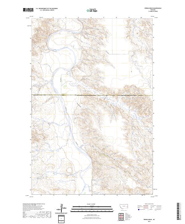
2024 Spring Draw
Custer County, MT
2024 Tepee Butte
Custer County, MT
2024 Tepee Butte NE
Custer County, MT
2024 The Knob
Custer County, MT
2024 Twin Buttes School
Custer County, MT
2024 Volborg
Custer County, MT
2024 Whitney Creek
Custer County, MT
2024 Witcher Reservoir
Custer County, MT