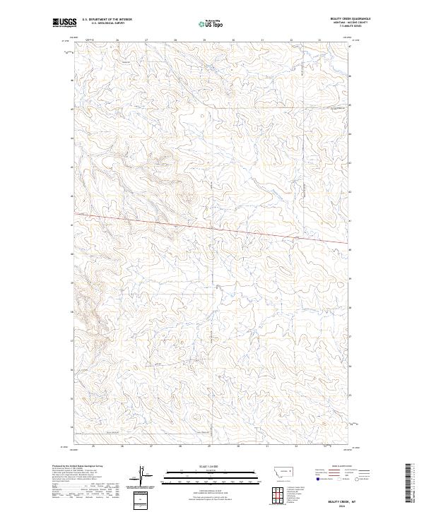
2024 Map of Beauty Creek
USGS Topo · Published 2024About this map
Beauty Creek and several other ephemeral drainage systems carve a detailed pattern of ridges and coulees across this McCone County landscape. The area is defined by its rural transit network, where routes like Beauty Valley Rd and Old Brockway Rd follow the natural contours of the high plains. Unlike more developed regions, the settlement pattern here remains dictated by the availability of water, with prominent features including Soda Creek, Dirty Creek, and Nelson Creek. To the south, Skull Creek Rd and Chalk Butte Rd provide access to the remote township corners. The map illustrates the persistent importance of section-line roads and named waterways in navigating the vast, open spaces of eastern Montana.
Find a feature on this map
17 named features on this map. Tap any name to fly to it.
Don’t see what you’re looking for? This feature index may not catch every label — zoom into the map to look around manually.
Map Details
Editions of this 2024 Beauty Creek Map
This is the sole edition of this map. No revisions or reprints were ever made.
Other maps of this area

1954 · Jordan
USGS Topo · 1:250,000

1954 · Glendive
USGS Topo · 1:250,000

1956 · Jordan
USGS Topo · 1:250,000

1957 · Glendive
USGS Topo · 1:250,000

1958 · Jordan
USGS Topo · 1:250,000

1958 · Glendive
USGS Topo · 1:250,000

1964 · Jordan
USGS Topo · 1:250,000

1965 · Hedstrom Lake
USGS Topo · 1:24,000

1965 · Watkins
USGS Topo · 1:24,000
1965 · Berry School
USGS Topo · 1:24,000