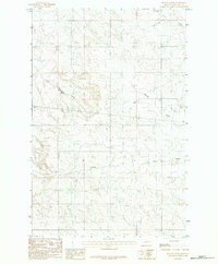
1983 Map of Beauty Creek
USGS Topo · Published 1983About this map
Soda Creek and Beauty Creek carve through the high plains of McCone County, creating a complex drainage system that defines this landscape. The 1983 provisional survey shows a sparsely populated area where cattle ranching and aviation are the primary markers of human presence. Centrally located in the terrain is a Landing Strip, providing a vital link for this remote ranching territory. To the north, the settlement of Cotter stands near the headwaters of the local creek systems. This map also preserves topographic details for Larson Ft and the winding course of Dirty Creek near the boundary of townships T 18 N and T 17 N. The sparse distribution of man-made features underscores the vastness of the Montana prairie in the late twentieth century.
Find a feature on this map
7 named features on this map. Tap any name to fly to it.
Don’t see what you’re looking for? This feature index may not catch every label — zoom into the map to look around manually.
Map Details
Editions of this 1983 Beauty Creek Map
This is the sole edition of this map. No revisions or reprints were ever made.
Other maps of this area

1954 · Jordan
USGS Topo · 1:250,000

1954 · Glendive
USGS Topo · 1:250,000

1956 · Jordan
USGS Topo · 1:250,000

1957 · Glendive
USGS Topo · 1:250,000

1958 · Jordan
USGS Topo · 1:250,000

1958 · Glendive
USGS Topo · 1:250,000

1964 · Jordan
USGS Topo · 1:250,000

1965 · Hedstrom Lake
USGS Topo · 1:24,000

1965 · Watkins
USGS Topo · 1:24,000
1965 · Berry School
USGS Topo · 1:24,000