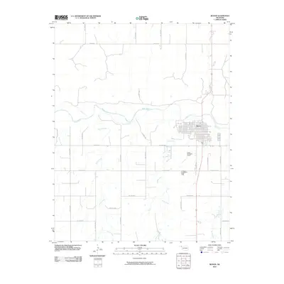
2010 Map of Beaver
USGS Topo · Published 2010About this map
Beaver serves as the focal point of this Panhandle landscape, situated at the confluence of several significant prairie waterways. The town layout is clearly defined against the surrounding agricultural terrain, which is segmented by a strictly ordered grid of rural routes such as Hollow E0140 and Beaver Rd. The drainage patterns of the Beaver River and its tributaries, including Sixmile Creek and Home Creek, create natural breaks in the geometric section lines. The proximity of the Beaver Cemetery and the Beaver Municipal Airport to the town center illustrates the concentrated development of this county seat. Researchers will find a landscape that balances traditional livestock and farming infrastructure with the logistical requirements of a regional hub in the early 21st century.
Find a feature on this map
25 named features on this map. Tap any name to fly to it.
Don’t see what you’re looking for? This feature index may not catch every label — zoom into the map to look around manually.
Map Details
Editions of this 2010 Beaver Map
This is the sole edition of this map. No revisions or reprints were ever made.
Other maps of this area

1954 · Perryton
USGS Topo · 1:250,000

1958 · Perryton
USGS Topo · 1:250,000

1970 · Mocane NW
USGS Topo · 1:24,000

1971 · Clear Lake NW
USGS Topo · 1:24,000
1971 · Mocane SW
USGS Topo · 1:24,000

1973 · Balko
USGS Topo · 1:24,000

1973 · Balko NE
USGS Topo · 1:24,000

1973 · Floris
USGS Topo · 1:24,000
1973 · Forgan
USGS Topo · 1:24,000

1973 · Beaver
USGS Topo · 1:24,000