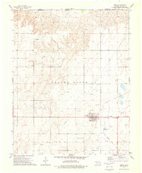
1973 Map of Forgan
USGS Topo · Published 1976About this map
Forgan serves as the primary hub of this high plains landscape, situated just south of the Kansas Oklahoma state line. The town's grid is clearly defined, supported by local infrastructure like the Water Tanks and Sewage Disposal Ponds, while the Forgan Cem lies just to the north. The surrounding terrain of Beaver North is defined by an extensive network of energy extraction, marked by numerous Gas Well and Oil Well sites that dot the sections.
Find a feature on this map
15 named features on this map. Tap any name to fly to it.
Don’t see what you’re looking for? This feature index may not catch every label — zoom into the map to look around manually.
Map Details
Editions of this 1973 Forgan Map
This is the sole edition of this map. No revisions or reprints were ever made.
Other maps of this area

1892 · Meade
USGS Topo · 1:125,000

1954 · Perryton
USGS Topo · 1:250,000

1955 · Dodge City
USGS Topo · 1:250,000

1958 · Perryton
USGS Topo · 1:250,000

1958 · Dodge City
USGS Topo · 1:250,000

1959 · Dodge City
USGS Topo · 1:250,000

1963 · Kismet SE
USGS Topo · 1:24,000

1963 · Irish Flats
USGS Topo · 1:24,000

1970 · Mocane NW
USGS Topo · 1:24,000

1971 · Kismet SW
USGS Topo · 1:24,000