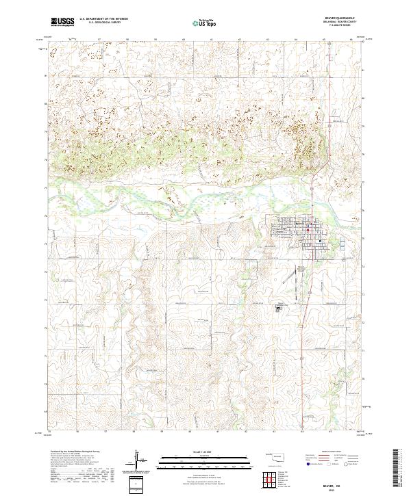
2022 Map of Beaver
USGS Topo · Published 2022About this map
Beaver serves as a prominent regional center in the Oklahoma Panhandle, situated along the southern banks of the Beaver River. This modern survey reveals a highly structured grid in the town core, anchored by the Beaver County Courthouse and extending through named thoroughfares from Avenue A to Avenue N. The surrounding landscape is defined by the drainage patterns of Home Creek and Sixmile Creek, which feed into the primary river valley. Notable local landmarks include the Beaver Municipal Airport to the south and the Beaver Pioneer Cemetery, which offers a focal point for genealogical research. The map illustrates the contemporary transition from the organized street blocks of the settlement to the open section lines of the surrounding rural townships, including t4n r23e and t5n r23e.
Find a feature on this map
37 named features on this map. Tap any name to fly to it.
Don’t see what you’re looking for? This feature index may not catch every label — zoom into the map to look around manually.
Map Details
Editions of this 2022 Beaver Map
This is the sole edition of this map. No revisions or reprints were ever made.
Other maps of this area

1954 · Perryton
USGS Topo · 1:250,000

1958 · Perryton
USGS Topo · 1:250,000

1970 · Mocane NW
USGS Topo · 1:24,000

1971 · Clear Lake NW
USGS Topo · 1:24,000
1971 · Mocane SW
USGS Topo · 1:24,000

1973 · Balko
USGS Topo · 1:24,000

1973 · Balko NE
USGS Topo · 1:24,000

1973 · Floris
USGS Topo · 1:24,000
1973 · Forgan
USGS Topo · 1:24,000

1973 · Beaver
USGS Topo · 1:24,000