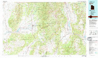
1980 Map of Beaver
USGS Topo · Published 1981About this map
Beaver and its surrounding agricultural valleys are central to this 1980 survey, showcasing a landscape defined by the water-management systems of the Beaver River and Sevier River. The high elevations of the Tsushara Mountains and Fish Lake Plateau separate these major river systems, while the presence of the Mineral Mountains to the west points toward the region's mining heritage. This era shows the established footprint of the Fishlake National Forest alongside small Mormon pioneer settlements like Manderfield, Greenville, and Adamsville. Industrial history is grounded in the presence of the Union Pacific and Denver and Rio Grande Western railroads, which facilitated the extraction of resources from sites such as the Iron Mine and Deer Trail Mine. Down in the valleys, reservoirs like Minersville Reservoir and Piute Reservoir illustrate the critical infrastructure required to sustain life in the Escalante Desert margin.
Find a feature on this map
62 named features on this map. Tap any name to fly to it.
Don’t see what you’re looking for? This feature index may not catch every label — zoom into the map to look around manually.
Map Details
Editions of this 1980 Beaver Map
2 editions found
Other maps of this area

1885 · St. George
USGS Topo · 1:250,000

1885 · Beaver
USGS Topo · 1:250,000

1885 · Fish Lake
USGS Topo · 1:250,000

1886 · Kanab
USGS Topo · 1:250,000

1886 · Escalante
USGS Topo · 1:250,000

1891 · St. George
USGS Topo · 1:250,000

1896 · Fish Lake
USGS Topo · 1:250,000

1932 · Sevier
USGS Topo · 1:62,500

1935 · Sevier
USGS Topo · 1:62,500

1937 · Delano Peak
USGS Topo · 1:48,000