1986 Map of Beaver
USGS Topo · Published 1986About this map
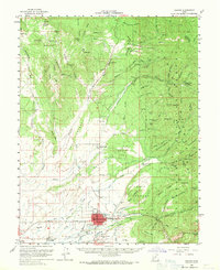
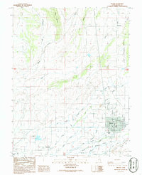
The Beaver river valley serves as the agricultural and civic anchor for this mid-1980s landscape, where irrigation networks define the settlement pattern. From the Beaver River and its South Branch, a complex system of man-made waterways like the Carter Ditch and the simple Flume distribute water across the valley floor. Small outposts like Manderfield to the north and Greenville to the southwest bracket the larger town center, while features like the Fish Hatchery and Adobe Yard Spring highlight the critical role of local hydrology.
Find a feature on this map
34 named features on this map. Tap any name to fly to it.
Don’t see what you’re looking for? This feature index may not catch every label — zoom into the map to look around manually.
Map Details
Editions of this 1986 Beaver Map
This is the sole edition of this map. No revisions or reprints were ever made.
Historical Maps of Beaver Through Time
5 maps found