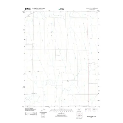
2011 Map of Beaver City SW
USGS Topo · Published 2011About this map
Beaver Creek and Sappa Creek define the drainage patterns of this rural landscape on the Nebraska-Kansas border. This 2011 survey illustrates a highly structured agricultural grid, where a network of section-line roads like Road 422 and Road 708 connects the high plains between these winding watercourses. The map is a significant resource for genealogists and local historians, as it preserves the exact locations of several early community hubs, including Lynden Cemetery, Rockton Cemetery, and Spring Green Cemetery. The presence of School Number 96 points to the area's history of rural school districts, while the Furnas Company Road Dam Number 1 indicates the intersection of modern infrastructure with the natural flow of Jones Creek.
Find a feature on this map
19 named features on this map. Tap any name to fly to it.
Don’t see what you’re looking for? This feature index may not catch every label — zoom into the map to look around manually.
Map Details
Editions of this 2011 Beaver City SW Map
This is the sole edition of this map. No revisions or reprints were ever made.
Other maps of this area

1893 · Norton
USGS Topo · 1:125,000

1896 · Arapahoe
USGS Topo · 1:125,000

1898 · Arapahoe
USGS Topo · 1:125,000

1951 · Norton
USGS Topo · 1:62,500

1951 · Norcatur
USGS Topo · 1:62,500

1954 · McCook
USGS Topo · 1:250,000

1954 · Goodland
USGS Topo · 1:250,000

1955 · Grand Island
USGS Topo · 1:250,000

1955 · Beloit
USGS Topo · 1:250,000

1956 · Goodland
USGS Topo · 1:250,000