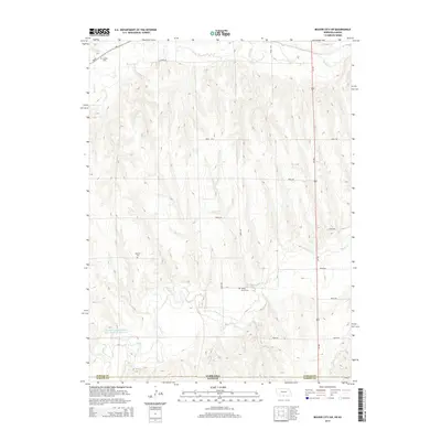
2014 Map of Beaver City SW
USGS Topo · Published 2014About this map
The state line between Nebraska and Kansas bisects this section of the High Plains, where the border between Furnas and Norton Counties marks a transition from northern agricultural uplands to the southern creek valleys. The landscape is defined by the winding course of Beaver Creek in the north and Sappa Creek in the south, supported by smaller tributaries like Jones Creek and Dutch Creek. These waterways dictated the placement of early rural infrastructure, visible in the distribution of local burial grounds. Genealogists may find interest in the documented locations of Lynden Cemetery, Rockton Cemetery, and Spring Green Cemetery, which remain as markers of the area's pioneer history. Transportation is anchored by the north-south corridor of Us-283, crossing a network of rural routes such as Road 707 and Road 420 that grid the prairie terrain.
Find a feature on this map
22 named features on this map. Tap any name to fly to it.
Don’t see what you’re looking for? This feature index may not catch every label — zoom into the map to look around manually.
Map Details
Editions of this 2014 Beaver City SW Map
This is the sole edition of this map. No revisions or reprints were ever made.
Other maps of this area

1893 · Norton
USGS Topo · 1:125,000

1896 · Arapahoe
USGS Topo · 1:125,000

1898 · Arapahoe
USGS Topo · 1:125,000

1951 · Norton
USGS Topo · 1:62,500

1951 · Norcatur
USGS Topo · 1:62,500

1954 · McCook
USGS Topo · 1:250,000

1954 · Goodland
USGS Topo · 1:250,000

1955 · Grand Island
USGS Topo · 1:250,000

1955 · Beloit
USGS Topo · 1:250,000

1956 · Goodland
USGS Topo · 1:250,000