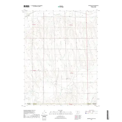
2017 Map of Beaver City SW
USGS Topo · Published 2017About this map
Rockton Cem and Spring Green Cem sit within the dissected uplands of the Kansas and Nebraska border, marking the presence of early prairie communities in this rural landscape. The terrain is defined by the winding paths of Beaver Cr to the north and Sappa Cr to the south, which have carved intricate drainage patterns through the region. This 2017 survey highlights a persistent grid of section lines and rural roads, such as RD 705 and RD 710, that organize the agricultural space. A notable human intervention in the hydrography is the Furnas Company Road Dam Reservoir Number 1, reflecting modern water management efforts in an area otherwise dominated by the natural flows of Dutch Cr and Jones Cr.
Find a feature on this map
28 named features on this map. Tap any name to fly to it.
Don’t see what you’re looking for? This feature index may not catch every label — zoom into the map to look around manually.
Map Details
Editions of this 2017 Beaver City SW Map
This is the sole edition of this map. No revisions or reprints were ever made.
Other maps of this area

1893 · Norton
USGS Topo · 1:125,000

1896 · Arapahoe
USGS Topo · 1:125,000

1898 · Arapahoe
USGS Topo · 1:125,000

1951 · Norton
USGS Topo · 1:62,500

1951 · Norcatur
USGS Topo · 1:62,500

1954 · McCook
USGS Topo · 1:250,000

1954 · Goodland
USGS Topo · 1:250,000

1955 · Grand Island
USGS Topo · 1:250,000

1955 · Beloit
USGS Topo · 1:250,000

1956 · Goodland
USGS Topo · 1:250,000