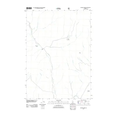
2011 Map of Beaver Creek
USGS Topo · Published 2011About this map
The Princess Blue Ribbon Mine and Happy Day Mine sit at the center of this drainage-focused landscape in Blaine County. This high-country region is defined by a dense network of waterways, including the winding Beaver Creek and its tributary, Little Beaver Creek. These streams have carved deep landmarks like McDonald Gulch and McKay Gulch, which guide the path of forest access routes such as Willow Creek Rd and NFD 017 Rd. In the southern reaches, the terrain rises toward Square Mountain, a prominent feature overlooking the headwaters of Camp Creek and Brush Creek. The map documents a rugged interior where mining interests and natural drainage systems intersect, reflecting the remote industrial and geographic character of central Idaho's mountains at the start of the 21st century.
Find a feature on this map
22 named features on this map. Tap any name to fly to it.
Don’t see what you’re looking for? This feature index may not catch every label — zoom into the map to look around manually.
Map Details
Editions of this 2011 Beaver Creek Map
This is the sole edition of this map. No revisions or reprints were ever made.
Other maps of this area

1895 · Hailey
USGS Topo · 1:125,000

1897 · Hailey
USGS Topo · 1:125,000

1900 · Sawtooth
USGS Topo · 1:125,000

1955 · Hailey
USGS Topo · 1:250,000

1957 · Bellevue
USGS Topo · 1:62,500

1957 · Blaine
USGS Topo · 1:62,500

1959 · Hailey
USGS Topo · 1:250,000

1962 · Hailey
USGS Topo · 1:250,000

1967 · Mahoney Butte
USGS Topo · 1:24,000

1970 · Dollarhide Mtn
USGS Topo · 1:24,000