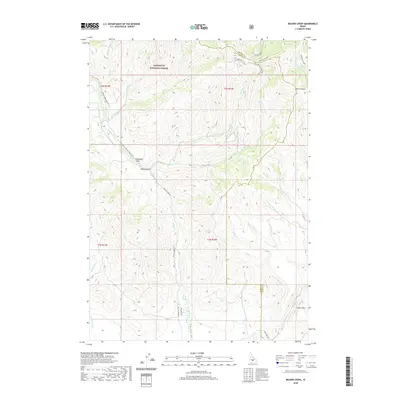
2020 Map of Beaver Creek
USGS Topo · Published 2020About this map
Sawtooth National Forest dominates this mountain landscape, where the administrative boundary between Blaine and Camas counties winds through the high ridges. The area is defined by a dense network of watercourses, with Beaver Creek and Little Beaver Creek serving as central drainage points for the surrounding gulches and canyons. A distinct lack of permanent settlements emphasizes the backcountry nature of this terrain, where transportation is limited to rugged routes like the Little Beaver Jeep Trail and Willow Creek Road. Geologic and topographic points of interest include the prominent Square Mountain in the southeast and the steep descent of Jumbo Canyon. The presence of labels such as Wolf-tone-Curran and family-named features like McKay Gulch suggest a history of resource extraction or early homesteading efforts in these high-altitude drainages.
Find a feature on this map
35 named features on this map. Tap any name to fly to it.
Don’t see what you’re looking for? This feature index may not catch every label — zoom into the map to look around manually.
Map Details
Editions of this 2020 Beaver Creek Map
This is the sole edition of this map. No revisions or reprints were ever made.
Other maps of this area

1895 · Hailey
USGS Topo · 1:125,000

1897 · Hailey
USGS Topo · 1:125,000

1900 · Sawtooth
USGS Topo · 1:125,000

1955 · Hailey
USGS Topo · 1:250,000

1957 · Bellevue
USGS Topo · 1:62,500

1957 · Blaine
USGS Topo · 1:62,500

1959 · Hailey
USGS Topo · 1:250,000

1962 · Hailey
USGS Topo · 1:250,000

1967 · Mahoney Butte
USGS Topo · 1:24,000

1970 · Dollarhide Mtn
USGS Topo · 1:24,000