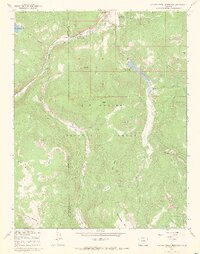
1967 Map of Beaver Creek Reservoir
USGS Topo · Published 1970About this map
The Rio Grande and its South Fork Rio Grande carve through the high-elevation landscape of the Rio Grande National Forest in this late 1960s topographic study. The area is defined by a series of water management and recreational sites, notably the Beaver Creek Reservoir and the smaller Million Reservoir to the north. These water bodies, along with the Beaver Creek Youth Camp and multiple sites like Park Creek Campground, indicate a mid-century focus on public forest use and water storage for the surrounding valley.
Find a feature on this map
39 named features on this map. Tap any name to fly to it.
Don’t see what you’re looking for? This feature index may not catch every label — zoom into the map to look around manually.
Map Details
Editions of this 1967 Beaver Creek Reservoir Map
3 editions found
Other maps of this area

1913 · Summitville
USGS Topo · 1:125,000

1914 · Creede
USGS Topo · 1:125,000

1915 · Summitville
USGS Topo · 1:125,000

1916 · Creede
USGS Topo · 1:125,000

1945 · Durango
USGS Topo · 1:250,000

1953 · Durango
USGS Topo · 1:250,000

1954 · Durango
USGS Topo · 1:250,000

1957 · Wolf Creek Pass
USGS Topo · 1:62,500

1957 · Spar City
USGS Topo · 1:62,500

1961 · Durango
USGS Topo · 1:250,000