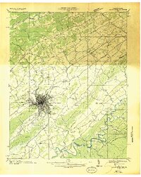
1935 Map of Beaver Creek
USGS Topo · Published 1935About this map
Bristol straddles the Virginia Tennessee line as a major rail hub in the mid-1930s, defined by the junction of the Southern Railway and the Norfolk and Western Railway. This Tennessee Valley Authority survey captures the city's growth just as the Appalachian Highway and Lee Highway were cementing its role as a regional crossroads. Beyond the dense street grid, the map documents a transition toward early aviation and recreation at the Bristol Landing Field and Blue Ridge Golf Course.
Find a feature on this map
75 named features on this map. Tap any name to fly to it.
Don’t see what you’re looking for? This feature index may not catch every label — zoom into the map to look around manually.
Map Details
Editions of this 1935 Beaver Creek Map
2 editions found
Other maps of this area

1891 · Roan Mountain
USGS Topo · 1:125,000

1891 · Abingdon
USGS Topo · 1:125,000

1893 · Cranberry
USGS Topo · 1:125,000

1894 · Roan Mountain
USGS Topo · 1:125,000

1894 · Abingdon
USGS Topo · 1:125,000

1895 · Cranberry
USGS Topo · 1:125,000

1897 · Bristol
USGS Topo · 1:125,000

1899 · Cranberry
USGS Topo · 1:125,000

1902 · Bristol
USGS Topo · 1:125,000

1902 · Cranberry
USGS Topo · 1:125,000