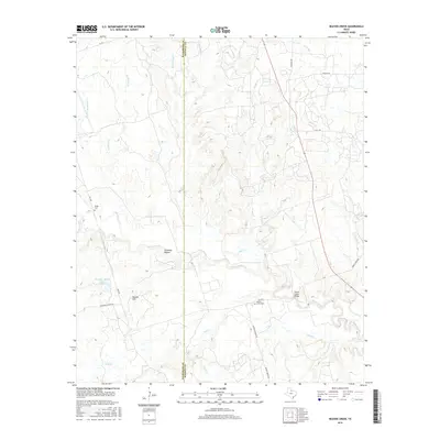
2016 Map of Beaver Creek
USGS Topo · Published 2016About this map
Beaver Creek carves a winding path through this North Texas ranching landscape, defining the boundary between Wilbarger and Wichita counties. The map documents a predominantly rural expanse where large-scale operations like the Waggoner Ranch Lake Number 6 underscore the importance of water management in this part of the Rolling Plains. The intersection of rural routes such as Boosters Station Rd and Swanson Ranch Rd provides access to family landmarks and resting places, including the Ronda Cem in the northwest and Beaver Creek Cem further south. Prominent terrain features like Potato Hill and Steinman Hollow break the horizon near the creek's floodplain. The presence of the Beaver Creek Bridge and various stream forks, such as W Fork Bluff Cr and Sunflower Cr, illustrate the drainage patterns that have shaped the local topography and settlement history.
Find a feature on this map
27 named features on this map. Tap any name to fly to it.
Don’t see what you’re looking for? This feature index may not catch every label — zoom into the map to look around manually.
Map Details
Editions of this 2016 Beaver Creek Map
This is the sole edition of this map. No revisions or reprints were ever made.
Other maps of this area

1915 · Barwise School
USGS Topo · 1:24,000

1916 · Electra
USGS Topo · 1:24,000

1916 · Fowlkes
USGS Topo · 1:24,000

1917 · Beaver Creek
USGS Topo · 1:24,000

1918 · Electra
USGS Topo · 1:31,680

1918 · Barwise School
USGS Topo · 1:31,680

1919 · Fowlkes
USGS Topo · 1:31,680

1920 · Beaver Creek
USGS Topo · 1:31,680

1954 · Wichita Falls
USGS Topo · 1:250,000

1955 · Lawton
USGS Topo · 1:250,000