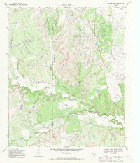
1968 Map of Beaver Creek
USGS Topo · Published 1971About this map
The Electra Oil Field and Consolidated Oil Field dominate this North Texas landscape, reflecting the intensive petroleum development of the late 1960s. Countless Oil Wells and numerous Drill Holes punctuate the terrain, particularly across the plateaus above the Beaver Creek valley. This 1968 survey reveals a specialized economy built on extraction, with industrial infrastructure like a Substa and several Gravel Pits supporting the oil operations.
Find a feature on this map
23 named features on this map. Tap any name to fly to it.
Don’t see what you’re looking for? This feature index may not catch every label — zoom into the map to look around manually.
Map Details
Editions of this 1968 Beaver Creek Map
This is the sole edition of this map. No revisions or reprints were ever made.
Other maps of this area

1915 · Barwise School
USGS Topo · 1:24,000

1916 · Electra
USGS Topo · 1:24,000

1916 · Fowlkes
USGS Topo · 1:24,000

1917 · Beaver Creek
USGS Topo · 1:24,000

1918 · Electra
USGS Topo · 1:31,680

1918 · Barwise School
USGS Topo · 1:31,680

1919 · Fowlkes
USGS Topo · 1:31,680

1920 · Beaver Creek
USGS Topo · 1:31,680

1954 · Wichita Falls
USGS Topo · 1:250,000

1955 · Lawton
USGS Topo · 1:250,000