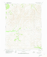
1970 Map of Beaver D-6
USGS Topo · Published 1973About this map
The Jim River flows through this interior Alaskan wilderness, as documented during a 1970 survey of the Yukon-Koyukuk region. This topographic study reflects a landscape dominated by complex drainage patterns, with Lansing Creek feeding into the main river from the northeast. The terrain is defined by its watercourses, including Keating Creek and Granite Creek, which carve through the high elevations of the Beaver quadrangle. This map represents an era of land management where boundaries were largely predetermined and unsurveyed, as noted by the Bureau of Land Management. The absence of roads or trails on the sheet emphasizes the undeveloped nature of the central Alaska interior during the early 1970s, making it a primary record for those studying the natural hydrology of the area before modern infrastructure.
Find a feature on this map
5 named features on this map. Tap any name to fly to it.
Don’t see what you’re looking for? This feature index may not catch every label — zoom into the map to look around manually.
Map Details
Editions of this 1970 Beaver D-6 Map
This is the sole edition of this map. No revisions or reprints were ever made.
Other maps of this area

1951 · Bettles
USGS Topo · 1:250,000

1951 · Chandalar
USGS Topo · 1:250,000

1951 · Beaver
USGS Topo · 1:250,000

1951 · Wiseman
USGS Topo · 1:250,000

1956 · Chandalar
USGS Topo · 1:250,000

1956 · Bettles
USGS Topo · 1:250,000

1956 · Wiseman
USGS Topo · 1:250,000

1956 · Beaver
USGS Topo · 1:250,000

1964 · Wiseman
USGS Topo · 1:250,000

1964 · Chandalar
USGS Topo · 1:250,000