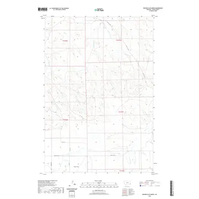
2020 Map of Beaver Flats North
USGS Topo · Published 2020About this map
Beaver Flats and the surrounding drainage basins of Carter County are defined by a complex network of seasonal watercourses and historical transit routes. The most prominent corridor is the Miles City Cutoff, which traverses the northern reaches of the quadrangle. This path once served as a significant regional link across the eastern Montana plains. The landscape is deeply etched by numerous creeks, including O'Fallon Cr and Little Beaver Cr, whose tributaries like School Section Cr and Ewalt Cr suggest a history of state land management and early ranching divisions. The southern portion of the map is characterized by a series of local roads, many bearing family names such as Georgie's Rd, Sterns Rd, and Meyers Rd, which provide evidence of the rural homesteading patterns that established this community.
Find a feature on this map
24 named features on this map. Tap any name to fly to it.
Don’t see what you’re looking for? This feature index may not catch every label — zoom into the map to look around manually.
Map Details
Editions of this 2020 Beaver Flats North Map
This is the sole edition of this map. No revisions or reprints were ever made.
Other maps of this area

1953 · Miles City
USGS Topo · 1:250,000

1954 · Ekalaka
USGS Topo · 1:250,000

1956 · Ekalaka
USGS Topo · 1:250,000

1957 · Miles City
USGS Topo · 1:250,000

1958 · Miles City
USGS Topo · 1:250,000

1958 · Ekalaka
USGS Topo · 1:250,000

1965 · Ekalaka
USGS Topo · 1:250,000

1979 · Blacktail Creek SE
USGS Topo · 1:24,000

1979 · Board Corral Creek
USGS Topo · 1:24,000

1979 · Beaver Flats South
USGS Topo · 1:24,000