
1984 Map of Beaver Island
USGS Topo · Published 1985About this map
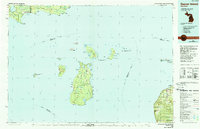
St James serves as the primary hub on Beaver Island, the largest of the archipelago shown in this mid-1980s planimetric survey. The map details a complex network of islands and coastal settlements along Lake Michigan, from the isolated outposts on Garden Island and High Island to the mainland communities of Cross Village and Good Hart along the Emmet County coast. The interior of Beaver Island is notably dominated by the Beaver Islands State Wildlife Research Area, which encompasses numerous inland water bodies like Font Lake, Barney Lake, and the southern Lake Geneserath.
Find a feature on this map
110 named features on this map. Tap any name to fly to it.
Don’t see what you’re looking for? This feature index may not catch every label — zoom into the map to look around manually.
Map Details
Editions of this 1984 Beaver Island Map
2 editions found
Other maps of this area

1931 · Epoufette SE
USGS Topo · 1:31,680

1931 · Seul Choix Point NE
USGS Topo · 1:31,680

1931 · Epoufette SW
USGS Topo · 1:31,680

1931 · Seul Choix Point NW
USGS Topo · 1:31,680

1931 · Manistique River SE
USGS Topo · 1:31,680

1931 · Blaney SW
USGS Topo · 1:31,680

1931 · Gould City SE
USGS Topo · 1:31,680

1931 · Blaney SE
USGS Topo · 1:31,680

1948 · Moran NW
USGS Topo · 1:31,680

1954 · Charlevoix
USGS Topo · 1:62,500